Fort Trumbull in New London in New London County, Connecticut — The American Northeast (New England)
Maury Hall
Building 28
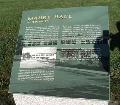
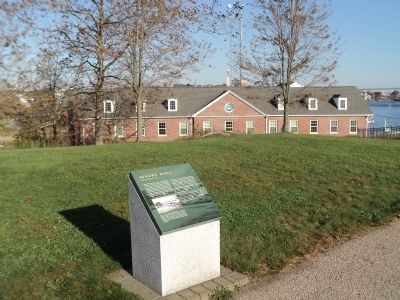
Maury Hall, a substantial two-story concrete building, stood on this site from the 1930s or early 1940s until 1999. It served as classrooms for the U.S. Maritime Service officers’ training program at Fort Trumbull during Worl War II. Known to the navy simply as Building 28, it housed the Electromagnetics Division of the Navy Underwater Sound Laboratory from 1948 to 1963. The Electromagnetics Division developed submarine antennas, radio communications systems, periscopes, and other optical equipment.
The floating wire antenna, also known as the buoyant cable antenna, was one of the important technological advancements developed here by teams of civilian engineers and scientists. First successfully tested in 1954, it consisted of a long wire that floated to the surface when a submarine was submerged below periscope depth. It received very low radio frequency signals, allowing contact with the submarine at lower depths than ever before possible. A more advanced version of the floating antenna is used on all U.S. submarines today.
Other work conducted here included research in optics, infrared radiation, microwaves, and radio waves from very high frequencies to extremely low frequencies. The Submarine Electromagnetics Division transferred to a new building in 1963. Building 28 served as administrative offices when the base closed in the 1990s.
Erected by Fort Trumbull State Park.
Topics. This historical marker is listed in these topic lists: Education • Forts and Castles • War, World II. A significant historical year for this entry is 1999.
Location. 41° 20.704′ N, 72° 5.58′ W. Marker is in New London, Connecticut, in New London County. It is in Fort Trumbull. Marker can be reached from East Street, on the left when traveling south. Marker is located in Fort Trumbull State Park. Touch for map. Marker is in this post office area: New London CT 06320, United States of America. Touch for directions.
Other nearby markers. At least 8 other markers are within walking distance of this marker. Fort Trumbull State Park (within shouting distance of this marker); Blockhouse (within shouting distance of this marker); North Battery (about 300 feet away, measured in a direct line); Bottom Reflected Active Sonar System (BRASS) (about 400 feet away); Fort Trumbull (about 400 feet away); Parade Ground (about 400 feet away); Cold War (about 500 feet away); The Barracks (about 500 feet away). Touch for a list and map of all markers in New London.
More about this marker. A picture of Building 28 at the lower left of the marker has a caption of “A 1954 navy facilities report called Building 28 ‘by far the best building on the station’ and noted that it offered ‘ideal conditions for laboratory operations.’ Designed in the international style, the architecture emphasized geometric forms free of any ornamentation. The flat roof, the bands of windows, and the plain cylindrical column at the entryway all served to accentuate the solid geometric quality of the building.”
Also see . . . History of Fort Trumbull. Friends of Fort Trumbull website. (Submitted on October 14, 2011, by Bill Coughlin of Woodland Park, New Jersey.)
Credits. This page was last revised on May 6, 2023. It was originally submitted on October 14, 2011, by Bill Coughlin of Woodland Park, New Jersey. This page has been viewed 415 times since then and 15 times this year. Photos: 1, 2, 3. submitted on October 14, 2011, by Bill Coughlin of Woodland Park, New Jersey.


