Cobleskill in Schoharie County, New York — The American Northeast (Mid-Atlantic)
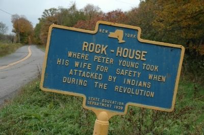
Rock-House
Where Peter Young took
his wife for safety when
attacked by Indians
during the Revolution
Erected 1939 by New York State Education Department.
Topics. This historical marker is listed in these topic lists: Colonial Era • Settlements & Settlers • War, US Revolutionary.
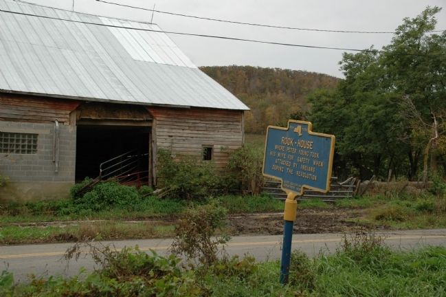
Location. 42° 43.561′ N, 74° 28.88′ W. Marker is in Cobleskill, New York, in Schoharie County. Marker is on Hubb Shutts Road (County Route 37), on the right when traveling west. Touch for map. Marker is at or near this postal address: 519 Hubb Shutts Road, Cobleskill NY 12043, United States of America. Touch for directions.
Other nearby markers. At least 8 other markers are within 5 miles of this marker, measured as the crow flies. Carlisle Grove Seminary (approx. 2.7 miles away); Burial Place (approx. 2.7 miles away); Shootout (approx. 3.3 miles away); World Wars Memorial Clock (approx. 3.3 miles away); Town of Cobleskill (approx. 3.4 miles away); War Memorial (approx. 3.4 miles away); Cherry Valley Junction (approx. 4.1 miles away); Kilts (approx. 4.2 miles away). Touch for a list and map of all markers in Cobleskill.
Regarding Rock-House. In 1778, when the Indians began their depredations in the Schoharie settlements, the patriots of New Rhinebeck made the house of Peter Young their rendezvous. Being but few in numbers, and the Tory neighbors becoming more venomous as their allies began to make their raids, this little company concluded to leave their homes and seek safety in the forts. A band of Indians assembled at a Tory's house in the neighborhood to capture them, upon which Peter Young started to take his wife, who was a cripple, to the Camps for safety; but fearing he would be unable to do so, she was taken to a small cave at the foot of the mountain and left there alone. Being supplied with provisions, she remained for several days in that place without being discovered by the Tories, whose houses were very near. The walls of this "rock-house," as it has since been called, for many years plainly showed the marks of the fires she built late at night, when all was quiet and danger of being seen had passed. After the Indians passed off to other fields for murder and devastation, her husband returned and carried her to the Camps, where she remained until the close of the war." History of Schoharie County, New York, 1713-1882: Volume 2 by William E. Roscoe; Truair, Smith & Bruce Printers and Binders, Syracuse, NY, 1882
Additional keywords. Schoharie Cobleskill
Credits. This page was last revised on June 16, 2016. It was originally submitted on October 16, 2011, by Howard C. Ohlhous of Duanesburg, New York. This page has been viewed 808 times since then and 40 times this year. Photos: 1. submitted on October 16, 2011, by Howard C. Ohlhous of Duanesburg, New York. 2. submitted on October 19, 2011, by Howard C. Ohlhous of Duanesburg, New York. • Bill Pfingsten was the editor who published this page.

