Abilene in Dickinson County, Kansas — The American Midwest (Upper Plains)
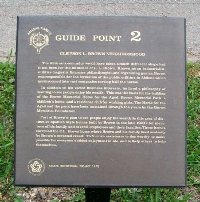
Cleyson L. Brown Neighborhood
The Abilene community would have taken a much different shape had it not been for the influence of C. L. Brown. Known as an industrialist, utilities magnate, financier, philanthropist, and organizing genius, Brown was responsible for the formation of the public utilities in Abilene which mushroomed into vast companies serving half the nation.
In addition to his varied business interests, he lived a philosophy of wanting to see people enjoy his wealth. This was the basis for the building of the Brown Memorial Home for the Aged, Brown Memorial Park, a children's home, and a residence club for working girls. The Home for the Aged and the park have been sustained through the years by the Brown Memorial Foundation.
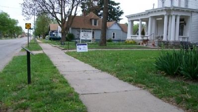
Part of Brown's plan to see people enjoy his wealth is this area of distinctive Spanish style homes built by Brown in the late 1920's for members of his family and several employees and their families. These homes surround the C.L. Brown home where Brown and his family lived modestly by Brown's creed: To furnish assistance to the worthy, to make possible for everyone's enjoyment in life, and to help others to help themselves.
Erected 1976 by Abilene Bicentennial Project. (Marker Number 2.)
Topics. This historical marker is listed in these topic lists: Charity & Public Work • Industry & Commerce • Settlements & Settlers.
Location. 38° 55.37′ N, 97° 12.843′ W. Marker is in Abilene, Kansas, in Dickinson County. Marker is on Buckeye Avenue near 8th Street, on the left when traveling north. Touch for map. Marker is at or near this postal address: 800 North Buckeye Avenue, Abilene KS 67410, United States of America. Touch for directions.
Other nearby markers. At least 8 other markers are within walking distance of this marker. Site of Abilene High School (about 500 feet away, measured in a direct line); St. John's Episcopal Church (approx. 0.2 miles away); Seelye Mansion (approx. ¼ mile away); Trinity Evangelical Lutheran Church (approx. 0.4 miles away); 301-309 North Buckeye Avenue (approx. 0.4 miles away); Dwight David Eisenhower (approx. 0.4 miles away); Texas Cattle Trail (approx. 0.4 miles away); United Building (approx. 0.4 miles away). Touch for a list and map of all markers in Abilene.
Also see . . .
1. C. L. Brown and His Affect on Abilene, Kansas. Dickinson County Historical Society blog entry (Submitted on October 18, 2011, by William Fischer, Jr. of Scranton, Pennsylvania.)
2. C.L. Brown. Wikipedia entry (Submitted on January 4, 2022, by Larry Gertner of New York, New York.)
Credits. This page was last revised on January 4, 2022. It was originally submitted on October 18, 2011, by William Fischer, Jr. of Scranton, Pennsylvania. This page has been viewed 734 times since then and 22 times this year. Photos: 1, 2. submitted on October 18, 2011, by William Fischer, Jr. of Scranton, Pennsylvania.

