Hastings in Dakota County, Minnesota — The American Midwest (Upper Plains)
Going with the Flow
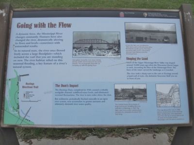
A dynamic force, the Mississippi River changes constantly. Humans have also changed the river, dramatically altering its flow and levels — sometimes with unintended results.
In its natural state, the river once flowed freely across a large floodplain — which included the trail that you are standing on now. The river habitat relied on this seasonal flooding, a key feature of a river's natural system.
Shaping the Land
Much of the Upper Mississippi River Valley was shaped around 15,000 years ago when the Wisconsin Glacier began to melt, increasing the flow of the Mississippi River. The force of the water carved the landscape as it traveled.
The river took a sharp turn to the east at Hastings around a hard wall of rock — the dolomite limestone bluff you see in front of you.
The Dam's Impact
The Hastings Dam, completed in 1930, created a reliably navigable channel, stabilized water levels, and eliminated seasonal fluctuations. The river is now wider above the dam.
But sediments, periodically flushed naturally in an open river system, now accumulate in greater amounts and ultimately diminish river water quality.
Erected by City of Hastings; National Park Service, U.S. Department of the Interior.
Topics. This historical marker is listed in these topic lists: Charity & Public Work • Natural Features • Waterways & Vessels. A significant historical year for this entry is 1930.
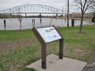
Location. 44° 44.767′ N, 92° 51.404′ W. Marker is in Hastings, Minnesota, in Dakota County. Marker can be reached from Lock and Dam Road, 0.3 miles north of 2nd Street West, on the right when traveling north. Marker is along the Hastings Riverfront Trail in Jaycee Park. Touch for map. Marker is in this post office area: Hastings MN 55033, United States of America. Touch for directions.
Other nearby markers. At least 8 other markers are within walking distance of this marker. Living in the Water (approx. 0.2 miles away); One Neighborhood, Many Stories (approx. ¼ mile away); Downtown Develops (approx. ¼ mile away); Hastings, Minnesota (approx. ¼ mile away); Downtown Hastings — Yesterday and Today (approx. ¼ mile away); American Legion Veterans Memorial (approx. ¼ mile away); Spiral Bridge (approx. ¼ mile away); Hastings Spiral Bridge (approx. 0.3 miles away). Touch for a list and map of all markers in Hastings.
More about this marker. [photo captions, clockwise]
• Navigation along the river stops entirely during winter months because the water freezes. This photograph shows the ice breaking up with the spring thaw. City of Hastings
• Before the dam was completed in 1930, farms such as this one were often flooded during the spring. This farm, owned by John Krohn, was located between Lake Rebecca and the Mississippi River. City of Hastings
• This map shows the river in 1896, before construction of the Hastings Dam. Spring Lake, once separated from the river by a narrow peninsula of land, became part of the Mississippi with the dam's installation. City of Hastings
• The United States Army Corps of Engineers began building the lock and dam at Hastings in 1927. The dam, seen here under construction, consists of a concrete structure 722 feet long. City of Hastings
Also see . . . Upper Mississippi River. Wikipedia entry. (Submitted on October 20, 2011.)
Credits. This page was last revised on December 9, 2020. It was originally submitted on October 20, 2011, by Keith L of Wisconsin Rapids, Wisconsin. This page has been viewed 581 times since then and 8 times this year. Photos: 1, 2, 3. submitted on October 20, 2011, by Keith L of Wisconsin Rapids, Wisconsin.


