Sutro Heights in San Francisco City and County, California — The American West (Pacific Coastal)
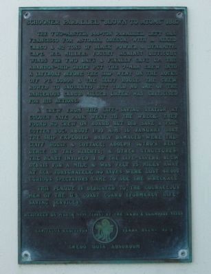
Schooner Parallel “Blown to Atoms” 1887
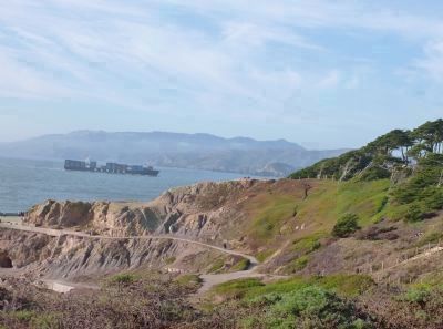
The two-masted, 148-ton Parallel left San Francisco for Astoria, Oregon, with a mixed cargo & 42 tons of black powder & dynamite. Capt. W.C. Miller, fought against difficult winds for two days & finally gave up. The abandon-ship order put the 7-man crew into a lifeboat before the ship went on the rocks off Pt. Lobos & the Cliff House. The crew rowed to Sausalito but told no one of the dangerous cargo. Miller later was criticised for his actions.
A crew from the life-saving station at Golden Gate Park went to the wreck. They found no crew on board but did save a forgotten dog. About 1:30 a.m. 16 January 1887 the ship exploded. Badly damaged were the: Cliff House & cottage; Adolph Sutro’s residence on the Heights; & other structures. The blast injured 3 of the life-savers, blew debris for a mile & was felt 15 miles away at sea. Fortunately, no lives were lost. 40,000 curious spectators came to see the wreckage.
This plaque is dedicated to the courageous men of the U.S. Coast Guard (formerly Life-Saving Service).
Erected 1994 by Yerba Buena Chapter No. 1, E Clampsus Vitus.
Topics and series. This historical marker is listed in these topic lists: Notable Events • Notable Places • Waterways & Vessels. In addition, it is included in the E Clampus Vitus series list. A significant historical date for this entry is January 16, 1887.
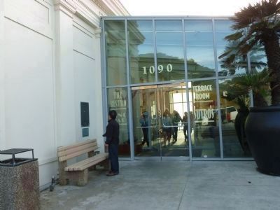
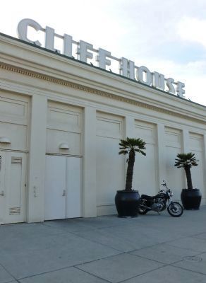
Location. 37° 46.715′ N, 122° 30.835′ W. Marker is in San Francisco, California, in San Francisco City and County. It is in Sutro Heights. Marker is on Point Lobos Avenue west of El Camino del Mar/48th Avenue. Touch for map. Marker is at or near this postal address: 1090 Point Lobos Avenue, San Francisco CA 94121, United States of America. Touch for directions.
Other nearby markers. At least 8 other markers are within walking distance of this marker. The New Cliff House (a few steps from this marker); The Parapet (about 400 feet away, measured in a direct line); The Sutro Home (about 800 feet away); The Carpet Beds (approx. 0.2 miles away); Lands End (approx. 0.2 miles away); The Conservatory (approx. 0.2 miles away); Peoples of the Coast (approx. 0.2 miles away); Exploring Lands End (approx. 0.2 miles away). Touch for a list and map of all markers in San Francisco.
Also see . . .
1. The Schooner Parallel Crashes by the Cliff House. HistorySmith entry (Submitted on September 28, 2020, by Larry Gertner of New York, New York.)
2. Cliff House, San Francisco. (Submitted on October 21, 2011, by Richard E. Miller of Oxon Hill, Maryland.)
Credits. This page was last revised on February 7, 2023. It was originally submitted on October 21, 2011, by Richard E. Miller of Oxon Hill, Maryland. This page has been viewed 969 times since then and 25 times this year. Photos: 1, 2. submitted on October 21, 2011, by Richard E. Miller of Oxon Hill, Maryland. 3. submitted on October 22, 2011, by Richard E. Miller of Oxon Hill, Maryland. 4, 5. submitted on October 21, 2011, by Richard E. Miller of Oxon Hill, Maryland. • Syd Whittle was the editor who published this page.


![The Cliff House [plaque on the wall beneath the <i>Parallel</i> Marker]. Click for full size. The Cliff House [plaque on the wall beneath the <i>Parallel</i> Marker] image. Click for full size.](Photos1/177/Photo177985.jpg?10222011121900PM)

