Lincoln Park in San Francisco City and County, California — The American West (Pacific Coastal)
Historic Shipwrecks - Lost at the Golden Gate
Inscription.
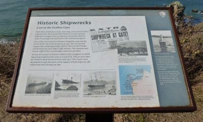
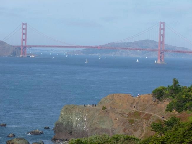
Swift tides, treacherous rocks, dense fog, and a narrow harbor entrance have always made San Francisco’s coast and port difficult to navigate. Over 300 known vessels have failed to make the passage and sank in the cold, treacherous waters.
One of the worst maritime disasters along the coast was the wreck of the City of Rio de Janeiro in 1901. The iron-hulled steamer hit a submerged ledge off Fort Point, in the Presidio, and flooded and sank within eight minutes. One hundred and twenty-eight of the 210 passengers and crew perished.
In 1922, the Lyman Q. Stewart collided with a freighter in a thick fog and grounded on the rocks at Lands End. Fifteen years later, the Frank H. Buck wrecked at the same spot. The wrecks were dynamited in 1938,, but parts of the engines of both ships are still visible from here during low tide.
Photo captions:
Newspaper article about Ohioan, October 8, 1936.
Loaded with 1,400 tons of washing machines, trucks and other cargo, the Ohioan swung too close to shore and crashed on the rocks at Point Lobos. Crowds watched as cargo was salvaged near shore.
Lyman A. Stewart, wrecked off Lands End, 1922 San Francisco National Maritime Museum
Frank H. Buck, wrecked off Lands End, 1937 San Francisco National Maritime Museum
[Chart of the Lands End coast with major wreck sites identified] Since San Francisco’s harbor became a vital shipping center at the start of the Gold Rush in 1849, hundreds of ships have been lost to the Golden Gate’s challenging conditions. Vivian Young
Sidebar:
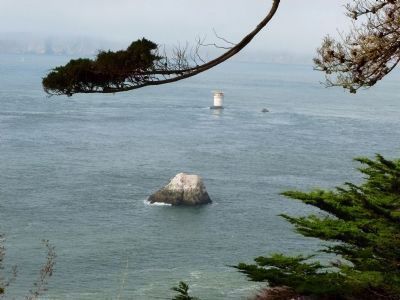
The devastating wreck of the City of Rio de Janiero in 1901 prompted the construction of the Mile Rock lighthouse. By 1906, fog signals blasted regularly and a light shone from the top tier of the lighthouse, warning ships of the perilous rocks nearby.
Locals affectionately called the tiny, four-tiered tower atop Mile Rock the “steel wedding cake.” The lighthouse was closed and dismantled in 1966, and was converted to a helicopter landing pad with an automated light.
Erected by Golden Gate National Recreation Area, National Park Service.
Topics and series. This historical marker is listed in these topic lists: Industry & Commerce • Natural Features • Notable Places • Waterways & Vessels. In addition, it is included in the Lighthouses series list. A significant historical month for this entry is October 2006.
Location. 37° 47.206′ N, 122° 30.279′ W. Marker is in San Francisco, California, in San Francisco
City and County. It is in Lincoln Park. Marker is on Lands End Trail north of El Camino del Mar. Touch for map. Marker is in this post office area: San Francisco CA 94121, United States of America. Touch for directions.
Other nearby markers. At least 8 other markers are within walking distance of this marker. The Arrival of the First Japanese Naval Ship (approx. ¼ mile away); "The Holocaust" (approx. ¼ mile away); Frances E. Willard (approx. 0.3 miles away); Soldiers who Perished in WWII (approx. 0.3 miles away); Jeanne d'Arc (approx. 0.3 miles away); Electric Streetcar Line (approx. 0.3 miles away); Western Terminus of the Lincoln Highway (approx. 0.3 miles away); Navigating the Golden Gate (approx. 0.4 miles away). Touch for a list and map of all markers in San Francisco.
Credits. This page was last revised on February 7, 2023. It was originally submitted on October 23, 2011, by Richard E. Miller of Oxon Hill, Maryland. This page has been viewed 1,298 times since then and 29 times this year. Photos: 1, 2, 3. submitted on October 23, 2011, by Richard E. Miller of Oxon Hill, Maryland. • Syd Whittle was the editor who published this page.


