Natick in Middlesex County, Massachusetts — The American Northeast (New England)
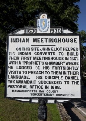
Indian Meetinghouse
1630 - 1930
Erected 1930 by Massachusetts Bay Colony-Tercentenary Commission.
Topics and series. This historical marker is listed in these topic lists: Churches & Religion • Colonial Era • Native Americans. In addition, it is included in the Massachusetts Bay Colony—Tercentenary Commission Markers series list. A significant historical year for this entry is 1651.
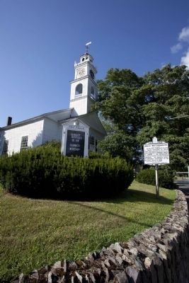
Location. 42° 16.38′ N, 71° 18.963′ W. Marker is in Natick, Massachusetts, in Middlesex County. Marker is at the intersection of Eliot Street (Massachusetts Route 16) and Union Street, on the left when traveling north on Eliot Street. South Natick Common. Touch for map. Marker is in this post office area: Natick MA 01760, United States of America. Touch for directions.
Other nearby markers. At least 8 other markers are within 6 miles of this marker, measured as the crow flies. Odd Fellow's Building (approx. 1.8 miles away); First Congregational Church (approx. 1.8 miles away); Site of the Home of Amos Mills (approx. 2.1 miles away); Wellesley Town Hall (approx. 2.1 miles away); Sherborn (approx. 2.9 miles away); In Honor of Two Magnificent and Historically Significant Trees (approx. 2.9 miles away); Near This Spot (approx. 4.6 miles away); Gen. Henry Knox Trail (approx. 5.7 miles away). Touch for a list and map of all markers in Natick.
Also see . . . Historical Markers Erected by Massachusetts Bay Colony Tercentenary Commission (1930). Original 1930 publication by the Commonwealth of Massachusetts of Tercentenary Commission Markers, commemorating the three hundredth anniversary of the Massachusetts Bay Colony. (Submitted on July 31, 2011, by Russell Chaffee Bixby of Bernardston, Massachusetts.)

Photographed By Allen C. Browne, August 9, 2015
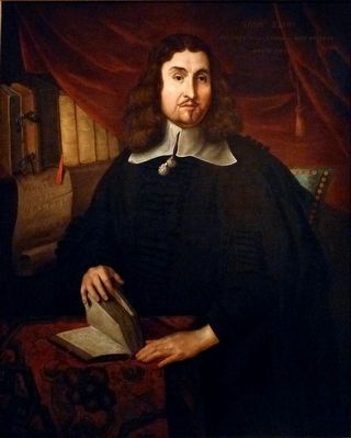
3. John Eliot
This portrait by of John Eliot an unknown artist hangs in the National Portrait Gallery in Washington, DC.
“No Puritan leader in seventeenth-century New England was more interested in the welfare of the region's Native American population than John Eliot. A graduate of Cambridge University, Eliot immigrated to Boston in 1631. While serving as the pastor of a church in Roxbury, Eliot began to search for ways to perform missionary work among the region's tribal communities. He studied the local Algonquian language, and by 1646 he was preaching to the native inhabitants in their own language.
In order to protect his potential Christian converts, he established the first of fourteen towns for so called ‘praying Indians’ in 1651. Perhaps his most extraordinary accomplishment, though, was the translation of the Bible into an Algonquian dialect a task that required Eliot to invent new words and new grammatical structures. Its publication in 1661 marked the first printing of a Bible in America.” — National Portrait Gallery
Credits. This page was last revised on October 25, 2020. It was originally submitted on July 31, 2011, by Russell Chaffee Bixby of Bernardston, Massachusetts. This page has been viewed 849 times since then and 35 times this year. Last updated on October 26, 2011, by Russell Chaffee Bixby of Bernardston, Massachusetts. Photos: 1, 2. submitted on July 31, 2011, by Russell Chaffee Bixby of Bernardston, Massachusetts. 3. submitted on October 24, 2015, by Allen C. Browne of Silver Spring, Maryland. • Bill Pfingsten was the editor who published this page.

