Greenbrier West in Chesapeake, Virginia — The American South (Mid-Atlantic)
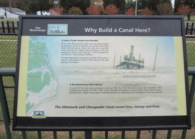
Why Build a Canal Here?
The Waterways
A Safer, Faster Route was Needed
Prior to the Revolutionary War, the most direct routes to transport goods to Norfolk and points north from North Carolina were, either the very slow overland route through the village of Great Bridge, or the very dangerous ocean route through “The Graveyard of the Atlantic” around Cape Hatteras.
Transporting goods was expensive; before the canal, a farmer could spend a third of the value of his crop getting it to market.
A Revolutionary Interruption
A canal for this area was proposed as early as 1728. By 1772, the canal survey was completed. The revolutionary events of 1775—1776, which included the Battle of Great Bridge, interrupted further development. Eighty-three years would pass before the Albemarle and Chesapeake Canal was realized.
Erected by Chesapeake Bay Gateways Network.
Topics. This historical marker is listed in these topic lists: War, US Revolutionary • Waterways & Vessels. A significant historical year for this entry is 1728.
Location. 36° 43.419′ N, 76° 14.812′ W. Marker is in Chesapeake, Virginia. It is in Greenbrier West. Marker can be reached from Locks Road, 0.6 miles North Battlefield Boulevard (Virginia Route 168), on the left when traveling west. Located in Great Bridge Lock Park. Touch for map. Marker is in this post office area: Chesapeake VA 23320, United States of America. Touch for directions.
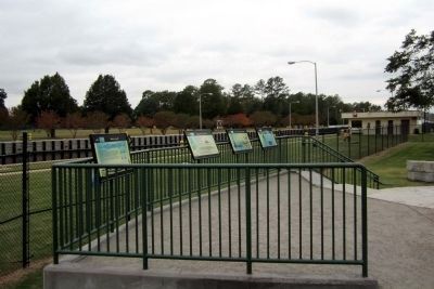
Other nearby markers. At least 8 other markers are within walking distance of this marker. What is a Lock? (here, next to this marker); The Iron Titans Tame the Marsh (here, next to this marker); Liquid Highways (here, next to this marker); Bridging the Past with the Present (within shouting distance of this marker); The Battle of Great Bridge (within shouting distance of this marker); Welcome (within shouting distance of this marker); Village of Great Bridge (about 500 feet away, measured in a direct line); Marine Veterans Memorial (approx. 0.4 miles away). Touch for a list and map of all markers in Chesapeake.
More about this marker. On the upper right is a photo of the "Tanker “Paraguay,” stuck on top of the old wreck, the “Urma,” on the beach at Kitty Hawk, North Carolina. Before the canal, goods were often taken by sea up the coast from North Carolina to Virginia…weather and coastal conditions often made for treacherous voyages."
Also see . . . Albemarle & Chesapeake Canal Historic District. Virginia Department of Historic Resources website entry (Submitted on October 30, 2011.)
Credits. This page was last revised on April 4, 2023. It was originally submitted on October 30, 2011, by Bernard Fisher of Richmond, Virginia. This page has been viewed 775 times since then and 17 times this year. Photos: 1, 2, 3. submitted on October 30, 2011, by Bernard Fisher of Richmond, Virginia.


