Newport in Newport County, Rhode Island — The American Northeast (New England)
Fort Adams Foundation
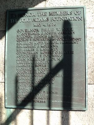
the Fort Adams Foundation
May 4, 1976
Governor Philip W. Noel
Lt. Governor J. Joseph Garrahy
Director Dennis J. Murphy, Jr.
George E. Howarth, 1st Commandant
Sen. Erich A. O’D. Taylor, President
Sen. Robert J. McKenna
Rep. James F. Mahoney
Councilman Robert O. Beattie
Antoinette F. Downing
John Nicholas Brown
Walter C. Hadley
Francis J. Boyle
Richard M. Wood
Colonel Frank Hale
Donato Andre D’Andrea
Leonard J. Panaggio
Francis A. Comstock
E. Newton Lawton
Frank Flynn
Lt. General W. P. Ennis
Alfred T. Klyberg
John N. Springett
T. Curtis Forbes
Topics. This historical marker is listed in this topic list: Forts and Castles. A significant historical month for this entry is May 1864.
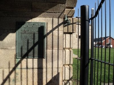
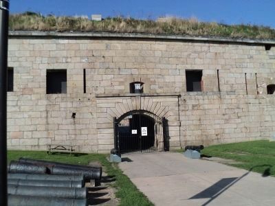
Location. 41° 28.725′ N, 71° 20.212′ W. Marker is in Newport, Rhode Island, in Newport County. Marker can be reached from Fort Adams Drive, on the left when traveling north. Marker is located in Fort Adams State Park, just inside the east gate. Touch for map. Marker is in this post office area: Newport RI 02840, United States of America. Touch for directions.
Other nearby markers. At least 8 other markers are within walking distance of this marker. Erich A. O’D. Taylor (a few steps from this marker); Understanding the Fort (within shouting distance of this marker); A Giant Among Forts (within shouting distance of this marker); Fort Adams (within shouting distance of this marker); Life in Fort Adams (within shouting distance of this marker); Building a Fortress (within shouting distance of this marker); Returning Old Glory 2001 (about 300 feet away, measured in a direct line); Defending Narragansett Bay (about 300 feet away). Touch for a list and map of all markers in Newport.
Credits. This page was last revised on November 2, 2020. It was originally submitted on October 30, 2011, by Bill Coughlin of Woodland Park, New Jersey. This page has been viewed 647 times since then and 13 times this year. Photos: 1, 2, 3. submitted on October 30, 2011, by Bill Coughlin of Woodland Park, New Jersey.


