Boston in Summit County, Ohio — The American Midwest (Great Lakes)
Boston Mills Road Bridge
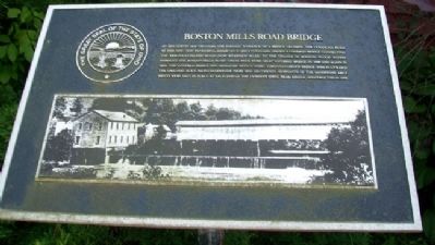
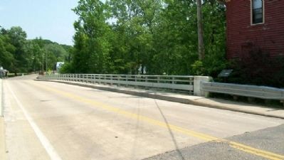
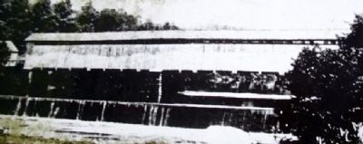
An 1834 survey map provides the earliest evidence of a bridge crossing the Cuyahoga River at this site. This rendering, based on a 1890's postcard, shows a covered bridge connecting the Akron-Cleveland Road (now Riverview Road) to the village of Boston. Flood waters damaged the Boston Mills Road "Trust with Burr Arch" covered bridge in 1898 and again in 1913. The covered bridge was replaced with a steel through-girder bridge which utilized the original rock faced sandstone piers and abutments. Remnants of the sandstone abutments were left in place at each end of the current steel beam bridge constructed in 1999.
Topics and series. This historical marker is listed in this topic list: Bridges & Viaducts. In addition, it is included in the Covered Bridges series list. A significant historical year for this entry is 1834.
Location. 41° 15.763′ N, 81° 33.62′ W. Marker is in Boston, Ohio, in Summit County. Marker is on Boston Mills Road near Zielenski Court, on the left when traveling west. Marker is at the west end of the bridge. Touch for map. Marker is in this post office area: Peninsula OH 44264, United States of America. Touch for directions.
Other nearby markers. At least 8 other markers are within walking distance of this marker. Rail and Industry Shape the Valley (a few steps from this marker); A River, Canal, and Railroad Town (a few steps from this marker); A River Renewed (within shouting distance of this marker); Protecting Cuyahoga Valley (within shouting distance of this marker); Cuyahoga Valley Scenic Railroad (within shouting distance of this marker); Industry Shapes the Valley (about 400 feet away, measured in a direct line); The Development of Valley Industry (about 400 feet away); Ride the Rails (about 400 feet away). Touch for a list and map of all markers in Boston.
Also see . . . Boston Mills Historic District. (Submitted on October 31, 2011, by William Fischer, Jr. of Scranton, Pennsylvania.)
Credits. This page was last revised on June 16, 2016. It was originally submitted on October 31, 2011, by William Fischer, Jr. of Scranton, Pennsylvania. This page has been viewed 570 times since then and 20 times this year. Photos: 1, 2, 3. submitted on October 31, 2011, by William Fischer, Jr. of Scranton, Pennsylvania.


