Near Millsboro in Sussex County, Delaware — The American Northeast (Mid-Atlantic)
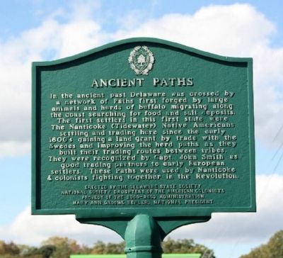
Ancient Paths
In the ancient past Delaware was crossed by a network of Paths first forged by large animals and herds of buffalo migrating along the coast searching for food and salt deposits. The first settlers in this first state were The Nanticoke (Tidewater) Native Americans settling and trading here since the early 1600's gaining a land grant by trade with the Swedes and improving the herd paths as they built their trading routes between tribes. They were recognized by Capt. John Smith as good trading partners to early European settlers. These Paths were used by Nanticoke & colonists fighting together in the Revolution.
Erected by The Delaware State Society, National Society Daughters of the American Colonists, Project of the 2000-2003 Administration, Mary Anne Groome Helper, National President.
Topics and series. This historical marker is listed in these topic lists: Colonial Era • Native Americans • Settlements & Settlers. In addition, it is included in the Daughters of the American Colonists series list.
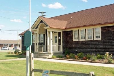
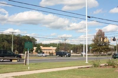
Location. Marker has been reported missing. It was located near 38° 36.851′ N, 75° 12.149′ W. Marker was near Millsboro, Delaware, in Sussex County. Marker was on John J Williams Highway (State Highway 24) near Mt. Joy / Oak Orchard Road, on the right when traveling east. Touch for map. Marker was at or near this postal address: 26675 John J Williams Highway, Millsboro DE 19966, United States of America. Touch for directions.
Other nearby markers. At least 8 other markers are within 4 miles of this location, measured as the crow flies. Veterans Memorial (approx. 0.4 miles away); Chair of Honor (approx. 0.4 miles away); Patton Medium Tank (approx. 0.4 miles away); Indian Mission School (approx. ¾ mile away); Harmony United Methodist Church (approx. one mile away); Rosedale Beach Hotel and Resort (approx. 1.3 miles away); Bullseye-Ferry Landing (approx. 2.3 miles away); Baltimore Hundred (approx. 4 miles away). Touch for a list and map of all markers in Millsboro.
Also see . . . History of the Naticoke Indian Tribe. Tribe website. (Submitted on November 1, 2011, by Mike Stroud of Bluffton, South Carolina.)
Credits. This page was last revised on April 18, 2024. It was originally submitted on November 1, 2011, by Mike Stroud of Bluffton, South Carolina. This page has been viewed 767 times since then and 36 times this year. Last updated on April 17, 2024, by Pete Skillman of Townsend, Delaware. Photos: 1, 2, 3. submitted on November 19, 2011, by Mike Stroud of Bluffton, South Carolina. • Devry Becker Jones was the editor who published this page.


