Beaver Falls in Beaver County, Pennsylvania — The American Northeast (Mid-Atlantic)
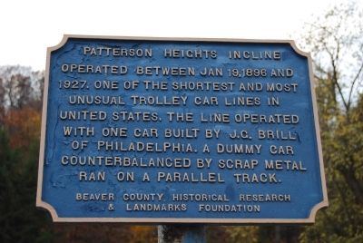
Patterson Heights Incline
Erected by Beaver County Historical Research and Landmarks Foundation.
Topics and series. This historical marker is listed in this topic list: Railroads & Streetcars. In addition, it is included in the Pennsylvania - Beaver County Historical Research and Landmarks Foundation series list. A significant historical date for this entry is January 19, 1821.
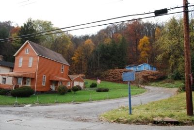
Location. 40° 44.525′ N, 80° 19.323′ W. Marker is in Beaver Falls, Pennsylvania, in Beaver County. Marker is at the intersection of Ross Hill Road and Hillside Avenue, on the right when traveling south on Ross Hill Road. Touch for map. Marker is in this post office area: Beaver Falls PA 15010, United States of America. Touch for directions.
Other nearby markers. At least 8 other markers are within walking distance of this marker. Union Drawn Steel (approx. 0.2 miles away); Chinese Workers in Beaver Falls (approx. ¼ mile away); Pennsylvania Canal System (approx. half a mile away); Underground Railroad (approx. 0.6 miles away); Joe Namath (approx. 0.8 miles away); The Carnegie Library (approx. 0.8 miles away); a different marker also named Underground Railroad (approx. 0.9 miles away); Merrick Art Gallery (approx. 0.9 miles away). Touch for a list and map of all markers in Beaver Falls.
Credits. This page was last revised on March 27, 2022. It was originally submitted on November 11, 2011, by Mike Wintermantel of Pittsburgh, Pennsylvania. This page has been viewed 1,485 times since then and 42 times this year. Photos: 1, 2. submitted on November 11, 2011, by Mike Wintermantel of Pittsburgh, Pennsylvania.

