The National Mall in Southwest Washington in Washington, District of Columbia — The American Northeast (Mid-Atlantic)
Why is the Washington Monument Temporarily Closed?
Washington Monument
— National Mall & Memorial Parks, National Park Service, U.S. Department of the Interior —
Inscription.
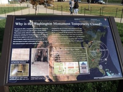
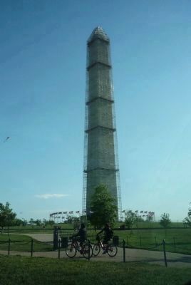
On August 23, 2011, a magnitude 5.8 earthquake centered in Virginia sent tremors throughout eastern North America. This seismic activity affected a number of Washington, D.C. landmarks, including the Washington Monument. National Park Service engineers and experts in historic preservation and earthquake engineering immediately assessed the physical impact in order to determine the best way to repair this national treasure and restore public access.
Completed by the U.S. Army Corps of Engineers in 1884, the Washington Monument honors George Washington for his generalship in the Revolutionary War (1775-1783) and for his later refusal to serve more than two terms as President of the United States (1789-1797). The Monument remains the world’s tallest freestanding stone structure, having weathered several earthquakes, including one in 1897 with a magnitude of 5.9.
For Another Bird’s Eye View:
The National Park Service suggests a visit to the 270-foot observation level of the historic Old Post Office Tower, open daily, except December 25th. Located at 12th Street and Pennsylvania, NW, the tower ranks third in height among Washington, D.C. buildings and offers sweeping views of the Nation’s Capital.
Erected by National Park Service, U.S. Department of the Interior.
Topics. This historical marker is listed in these topic lists: Architecture • Arts, Letters, Music • Disasters. A significant historical date for this entry is December 25, 1982.
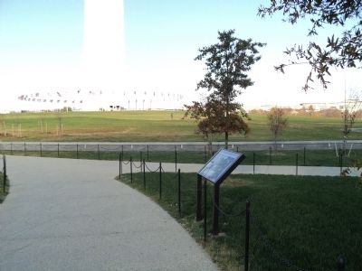
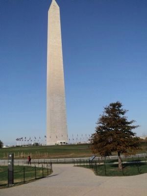
Location. Marker has been permanently removed. It was located near 38° 53.344′ N, 77° 2.002′ W. Marker was in Southwest Washington in Washington, District of Columbia. It was in The National Mall. Marker was on 15th Street Southwest north of Jefferson Drive Southwest, on the left when traveling north. Marker is located on the east side of the Washington Monument. Touch for map. Marker was in this post office area: Washington DC 20024, United States of America.
We have been informed that this sign or monument is no longer there and will not be replaced. This page is an archival view of what was.
Other nearby markers. At least 8 other markers are within walking distance of this location. A Monumental Legacy (a few steps from this marker); Washington: The Man (within shouting distance of this marker); Washington: The Monument (within shouting distance of this marker); Washington: The City (within shouting distance of this marker); a
different marker also named A Monumental Legacy (about 300 feet away, measured in a direct line); Raoul Wallenberg Place (about 500 feet away); Smokey Bear Blue Spruce (about 500 feet away); Jean Hillery and Thomas Quadros (about 600 feet away). Touch for a list and map of all markers in Southwest Washington.
More about this marker. The background of the marker shows a map of North America indicating the epicenter of the earthquake in Mineral, Virginia and its proximity to Washington, D.C. as well as Toronto, Ontario and Atlanta, Georgia.
Photographs at the lower left of the marker depict “Cracks in the pyramidion on the west side of the Monument.”; “Daylight appear[ing] where mortar and historic joint filler once were.”; and “National Park Service personnel amidst fallen marble and mortar.”
Finally, under the Bird’s Eye View sidebar is a map of the National Mall indicating the location of the Washington Monument. Next to this is a picture of The Old Post Office Tower.
Credits. This page was last revised on January 30, 2023. It was originally submitted on November 13, 2011, by Bill Coughlin of Woodland Park, New Jersey. This page has been viewed 697 times since then and 9 times this year. Photos: 1, 2, 3. submitted on November 13, 2011, by Bill Coughlin of Woodland Park, New Jersey. 4. submitted on January 9, 2014, by Richard E. Miller of Oxon Hill, Maryland.


