Savannah in Chatham County, Georgia — The American South (South Atlantic)
Sherman's March To The Sea:
Battle of Shaw's Bridge and Shaw's Dam
Inscription.
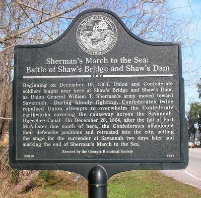
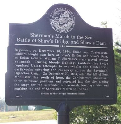
Beginning on December 10, 1864, Union and Confederate soldiers fought near here at Shaw’s Bridge and Shaw’s Dam, as Union General William T. Sherman’s army moved toward Savannah. During bloody fighting, Confederates twice repulsed Union attempts to overwhelm the Confederate earthworks covering the causeway across the Savannah-Ogeechee Canal. On December 20, 1864, after the fall of Fort McAllister due south of here, the Confederates abandoned their defensive positions and retreated into the city, setting the stage for the surrender of Savannah two days later and marking the end of Sherman’s March to the Sea.
Erected 2002 by Georgia Historical Society. (Marker Number 25-19.)
Topics and series. This historical marker is listed in this topic list: War, US Civil. In addition, it is included in the Georgia Historical Society, and the Sherman’s March to the Sea series lists. A significant historical month for this entry is December 1909.
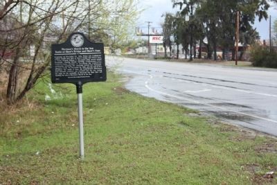
Location. 32° 4.589′ N, 81° 9.545′ W. Marker is in Savannah, Georgia, in Chatham County. Marker is on Chatham Parkway, on the right when traveling south. Located between Telfair Place and Telfair Road. Touch for map. Marker is in this post office area: Savannah GA 31405, United States of America. Touch for directions.
Other nearby markers. At least 8 other markers are within 3 miles of this marker, measured as the crow flies. Robert Sengstacke Abbott Boyhood Home (approx. 1.8 miles away); Jasper Spring (approx. 2 miles away); a different marker also named Jasper Spring (approx. 2 miles away); Largest Slave Sale in Georgia History (approx. 2.1 miles away); Moses J. Jackson (approx. 2.4 miles away); Hudson Hill (approx. 2.4 miles away); First Schools in West Savannah (approx. 2.4 miles away); Commercial Development of Western Savannah (approx. 2˝ miles away). Touch for a list and map of all markers in Savannah.
Additional commentary.
1. An excerpt from the Georgia Historical Quarterly
...Summer 2005, Vol. 89 Issue 2, p 135, 21 p:
The siege lines on the western edge of the city ran, on and off, for some twelve to thirteen miles from the Savannah River to Little Ogeechee River and along the various river approaches, and much of it is discernible today. Fort Pulaski, Fort Jackson, and Fort McAllister are well preserved and open to the public. Fort Bartow at Causton Bluff is still visible despite recent development and a large earthen fort remains at the southern end of Wormsloe Plantation. Also
on Wormsloe are extensive Confederate earthworks built to guard the wooden bridge (long since gone) connecting Isle of Hope with Skidaway Island. These positions were garrisoned by troops, including the Chatham Artillery, from nearby Camp Claghorn on Isle of Hope. Gun positions can still be seen at Rose Dhu near Coffee Bluff. Also the remnants of Fort Boggs can be found on the Savannah Golf and Country Club. Finally, an impressive set of gun positions and flanking trenches lie in the woods adjacent to Abercorn Street across from Armstrong Atlantic State University, although the left flank of these positions has been cut off by the expansion of the road. These works were apparently placed there to guard Montgomery Road, which then ran down a portion of what is today Abercorn Street, and the nearby Gulf & Atlantic rail line.
— Submitted January 25, 2008, by Mike Stroud of Bluffton, South Carolina.
Credits. This page was last revised on April 17, 2020. It was originally submitted on January 25, 2008, by Mike Stroud of Bluffton, South Carolina. This page has been viewed 6,302 times since then and 61 times this year. Photos: 1. submitted on November 26, 2016, by Michael C. Wilcox of Winston-Salem, North Carolina. 2. submitted on January 25, 2008, by Mike Stroud of Bluffton, South Carolina. 3. submitted on March 6, 2011, by Mike Stroud of Bluffton, South Carolina. • Craig Swain was the editor who published this page.


