Fort Washington in Prince George's County, Maryland — The American Northeast (Mid-Atlantic)
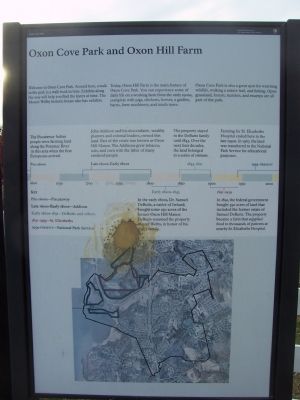
Oxon Cove Park and Oxon Hill Farm
Inscription.
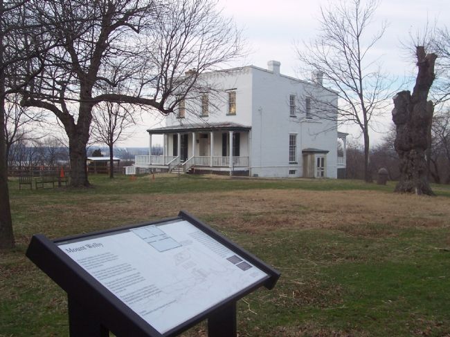
Welcome to Oxon Cove Park. Around here a walk in the park is a walk back in time. Exhibits along the way will help you find the layers of time. The Mount Welby historic house also has exhibits.
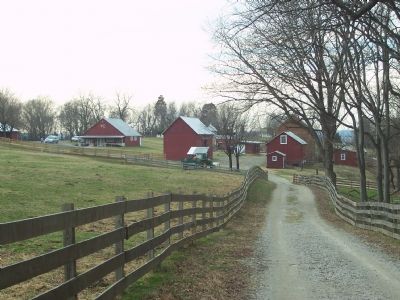
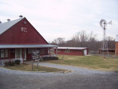
Today Oxon Hill Farm is the main feature of Oxon Cove Park. You can experience some of daily life on a working farm from the early 1900s, complete with pigs, chicken, horses, a garden, barns, farm machinery, and much more.
Oxon Cove Park is also a great spot for watching wildlife, walking a nature trail, and fishing. Open grassland, forests, marshes and swamps are all part of the park.
[Marker includes a time line as follows]:
Pre-1600s: The Piscataway Indian people were farming land along the Potomac River in this area when the first Europeans arrived.
Late 1600s-Early 1800s: John Addison and his descendants, wealthy planters and colonial leaders, owned this land. Part of the estate was known as Oxon Hill Manor. The Addisons grew tobacco oats and corn with the labor of many enslaved people.
Early 1800s-1843: In the early 1800s, Dr. Samuel DeButts, a native of Ireland bought some 250 acres of the former Oxon Hill Manor. DeButts renamed the property Mount Welby in honor of his wife's family.
1843-1891: The property stayed in the family until 1843. Over the next four decades the land belonged to a series of owners.
1891-1959: In 1891 the federal government bought 350 acres of land that include the former estate of Samuel DeButts. The property became a farm that provided food to thousands of patients at nearby St. Elizabeths Hospital.
1959-present: Farming for St. Elizabeths Hospital ended here in the late 1950s. In 1967, the land was transferred to the National Park Service for educational purposes.
Erected by National Park Service, U.S. Department of the Interior.
Topics. This historical marker is listed in these topic lists: Agriculture • Colonial Era. A significant historical year for this entry is 1843.
Location. 38° 48.096′ N, 77° 0.262′ W. Marker is in Fort Washington, Maryland, in Prince George's County. Marker is on Oxon Hill Bike Trail, 0.1 miles north of Oxon Hill Road (State Route 414). The Marker is at the farm's main entrance gate which is at the west end of its public parking lot, just north of the Capital Beltway (I-95) and accessible only from Oxon Hill Road on the south side of the Beltway via the Bald Eagle Road and bridge over the Beltway. Touch for map. Marker is at or near this postal address: 6411 Oxon Hill Road, Oxon Hill MD 20745, United States of America. Touch for directions.
Other nearby markers. At least 8 other markers are within walking distance of this marker. War All Around (a few steps from this marker); A Park with a Past
(within shouting distance of this marker); A Voice Unheard… (within shouting distance of this marker); A Farm for St. Elizabeths, 1891-1950 (about 300 feet away, measured in a direct line); Sweet Sorghum (about 700 feet away); Two Centuries of Farm Buildings (approx. 0.2 miles away); Why a Brick Stable? (approx. 0.2 miles away); Root Cellar (approx. 0.2 miles away). Touch for a list and map of all markers in Fort Washington.
More about this marker. The turn off is at the first signal light on Oxon Hill Road (MD 414)west of Indian Highway (MD 210).
Related markers. Click here for a list of markers that are related to this marker. To better understand the relationship, study each marker in the order shown.
Also see . . .
1. National Park Service website for Oxon Cove Park/Oxon Hill Farm. (Submitted on January 26, 2008, by Richard E. Miller of Oxon Hill, Maryland.)
2. St. Elizabeths Hospital. (Submitted on January 28, 2008, by Richard E. Miller of Oxon Hill, Maryland.)
3. Oxon Cove Park and Oxon Hill Farm. - National
Register of Historic Places (2003) (Submitted on October 31, 2011, by Richard E. Miller of Oxon Hill, Maryland.)
4. Jacob Shaw on the Underground Railroad. (Submitted on November 8, 2011, by Richard E. Miller of Oxon Hill, Maryland.)
Additional keywords. Jacob Shaw; Salubria; Berry Plantation; slavery
Credits. This page was last revised on March 3, 2023. It was originally submitted on January 26, 2008, by Richard E. Miller of Oxon Hill, Maryland. This page has been viewed 5,300 times since then and 53 times this year. Last updated on November 14, 2011, by Richard E. Miller of Oxon Hill, Maryland. Photos: 1, 2, 3. submitted on January 26, 2008, by Richard E. Miller of Oxon Hill, Maryland. 4, 5. submitted on January 27, 2008, by Richard E. Miller of Oxon Hill, Maryland. 6. submitted on October 30, 2011, by Richard E. Miller of Oxon Hill, Maryland. • Bill Pfingsten was the editor who published this page.
![Oxon Cove ["Creek"] - view toward the Anacostia Fwy. (I-295) and the Potomac River. Click for full size. Oxon Cove ["Creek"] - view toward the Anacostia Fwy. (I-295) and the Potomac River image. Click for full size.](Photos1/178/Photo178994.jpg?1122020101000PM)