Near Millsboro in Sussex County, Delaware — The American Northeast (Mid-Atlantic)
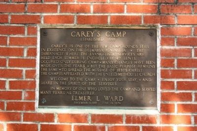
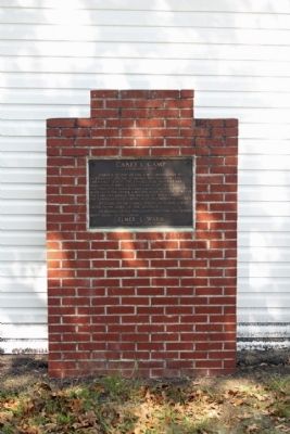
Carey's Camp
Welcome to the camp, * enjoy your stay, * and share in the spirit of the services.
In memory of one who loved the camp and served many years as treasurer:
December 11, 1903 June 28, 1974
Topics and series. This historical marker is listed in these topic lists: African Americans • Churches & Religion. In addition, it is included in the United Methodist Church Historic Sites series list. A significant historical month for this entry is December 1814.
Location. 38° 33.514′ N, 75° 22.029′ W. Marker is near Millsboro, Delaware, in Sussex County. Marker is on Careys Camp Road, on the left when traveling east. Located between Cross Keys Road and Atkins Court. Touch for map. Marker is at or near this postal address: 47 Careys Camp Rd, Millsboro DE 19966, United States of America. Touch for directions.
Other nearby markers. At least 8 other markers are within 5 miles of this marker, measured as the crow flies. A different marker also named Carey's Camp (a few steps from this marker); Gumboro Hundred (approx. 2.7 miles away); Godwin's School - District #190 (approx. 3.1 miles away); Bethany United Methodist Church (approx. 3.2 miles away); Westwoods Methodist Church (approx. 3˝ miles away); Hickory Hill Methodist Church (approx. 3.6 miles away); Jones Cemetery (approx. 4.3 miles away); Trinity Methodist Church (approx. 4˝ miles away). Touch for a list and map of all markers in Millsboro.
Regarding Carey's Camp. National Register of Historic Places:
Carey's Camp Meeting Ground ** (added 1973 - - #73000557)
♦ Historic Significance: Event
♦ Area of Significance: Religion, Social History
♦ Period of Significance: 1875-1899
♦ Historic Function: Domestic, Religion
♦ Current Function: Domestic, Religion
♦ Current Sub-function: Camp
Additional commentary.
1. The Delmarva Peninsula
is a large peninsula on the East Coast of the United States, occupied by most of Delaware and portions of Maryland and Virginia. The peninsula is almost 180 by 60 miles (300 by 100 km), and is bordered by the Chesapeake Bay on the west, and the Delaware River, Delaware Bay, and Atlantic Ocean on the east.
— Submitted December 1, 2011, by Mike Stroud of Bluffton, South Carolina.
2. Carey's Camp
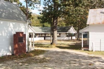
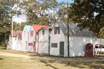
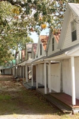
was established in 1888 as a Methodist camp meeting near Millsboro, Delaware. Traditionally occupied for two weeks in August for prayer and religious instruction, the camp is composed of 47 wood cabins (called "tents") in an oval around a tabernacle. As with many such meeting grounds, the camp is located in a grove of oaks trees. The front-gabled cabins almost touch each other. Each cabin has a window in the gable and a porch on the front. The rear of the porch is entirely open to the interior of the house, so that the cabin's occupants could see and be seen from the center. An enclosed kitchen is in the back of the cabin. Sleeping rooms are located upstairs.
Tents are usually owned by families, although a few tents, such as the preacher's, are owned by the camp committee. A boarding tent with six sleeping rooms offers food, and a confectionery is located outside the circle. At the center of the circle is the tabernacle. Originally a long shed, two arms were added to make it cruciform in shape, with three arms used for seating while
a fourth serves as a chancel. Hinged panels open to allow a view into the tabernacle from outside. Benches outside accommodate overflow.(wikipedia)
— Submitted December 1, 2011, by Mike Stroud of Bluffton, South Carolina.
Credits. This page was last revised on September 17, 2022. It was originally submitted on November 23, 2011, by Mike Stroud of Bluffton, South Carolina. This page has been viewed 627 times since then and 23 times this year. Photos: 1, 2, 3, 4, 5. submitted on December 1, 2011, by Mike Stroud of Bluffton, South Carolina.
