Mesa in Maricopa County, Arizona — The American Mountains (Southwest)
Prehistoric Irrigation in the Salt River Valley
Inscription.
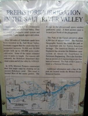
Approximately 300 B.C. Prehistoric Indians entered the Salt River Valley. They developed an extensive canal system and raised corn, beans, squash, agave and cotton.
Over 500 miles of Hohokam canal have been recorded in the Salt River Valley. Estimates suggest that the canals may have supported between 30,000 and 60,000 people with up to 100,000 acres under cultivation. Some of the canals extended over 12 miles in length. For reasons still unknown, the Hohokam abandoned their canal system and left the valley by 1450 A.D.
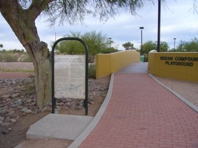
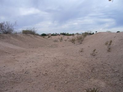
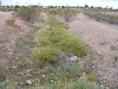
In 1878, Mormon Pioneers constructed their first major canal by cleaning out an ancient Hohokam canal. This canal is located West of the cactus garden. The bridge to the playground spans another prehistoric canal. A third ancient canal is located just North of the playground.
The Park of the Canals preserves about 4,500 feet of ancient canals. The National Geographic Society has listed this park as an important site for Native American heritage. The American Society of Civil Engineers has awarded the Hohokam canal system an Award for Excellence in Prehistoric Engineering. This is the first time that an ancient civil engineering project has been so honored. The Park of the Canals is listed as a National Historic site.
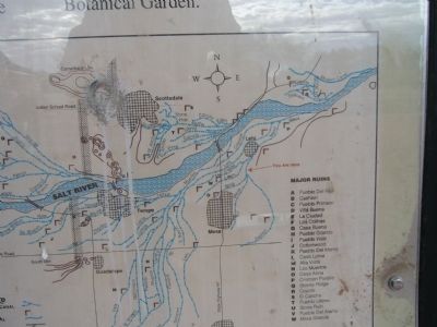
Additional information and a map of the park are located inside the Brinton Desert Botanical Garden.
Topics and series. This historical marker is listed in these topic lists: Agriculture • Anthropology & Archaeology • Bridges & Viaducts • Native Americans. In addition, it is included in the ASCE Civil Engineering Landmarks series list. A significant historical year for this entry is 1450.
Location. 33° 26.753′ N, 111° 48.887′ W. Marker is in Mesa, Arizona, in Maricopa County. Marker can be reached from North Horne Avenue, 0.4 miles south of East McKellips Road. Marker is in the Park of the Canals. Touch for map. Marker is in this post office area: Mesa AZ 85203, United States of America. Touch for directions.
Other nearby markers. At least 8 other markers are within 3 miles of this marker, measured as the crow flies. Site of Old Fort Utah (approx. 0.9 miles away); Mesa Grande (approx. 2 miles away); Mesa (approx. 2.1 miles away); Sirrine House (approx. 2.1 miles away); Arizona's Honeymoon Trail (approx. 2.1 miles away); Mesa Pioneer Monument (approx. 2.1 miles away); Mesa Woman's Club House (approx. 2.1 miles away); Zenos Co-Op (approx. 2.4 miles away). Touch for a list and map of all markers in Mesa.
Also see . . . Hohokam Irrigation. In Mesa, there is "Park of the Canals" which boasts large hand-dug canals that were originally made by the Hohokam, and later deepened by the Mormon settlers. (Submitted on November 27, 2011, by Bill Kirchner of Tucson, Arizona.)
Credits. This page was last revised on August 16, 2020. It was originally submitted on November 27, 2011, by Bill Kirchner of Tucson, Arizona. This page has been viewed 1,414 times since then and 155 times this year. Photos: 1, 2, 3, 4, 5. submitted on November 27, 2011, by Bill Kirchner of Tucson, Arizona. • Syd Whittle was the editor who published this page.
