Near Buena Vista in Amherst County, Virginia — The American South (Mid-Atlantic)
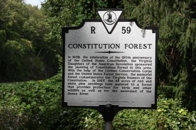
Constitution Forest
Erected 1987 by Department of Conservation and Historic Resources. (Marker Number R-59.)
Topics and series. This historical marker is listed in these topic lists: Charity & Public Work • Horticulture & Forestry. In addition, it is included in the Civilian Conservation Corps (CCC), and the Virginia Department of Historic Resources (DHR) series lists. A significant historical year for this entry is 1938.
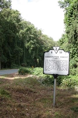
Location. 37° 44.546′ N, 79° 18.012′ W. Marker is near Buena Vista, Virginia, in Amherst County. Marker is at the intersection of Lexington Turnpike / Midland Trail (U.S. 60) and Blue Ridge Parkway and Panther Falls Road, on the right when traveling east on Lexington Turnpike / Midland Trail. Touch for map. Marker is in this post office area: Vesuvius VA 24483, United States of America. Touch for directions.
Other nearby markers. At least 8 other markers are within 8 miles of this marker, measured as the crow flies. Amherst County / Rockbridge County (a few steps from this marker); Old Court House (approx. 3 miles away); Veterans Memorial (approx. 3.1 miles away); Charlie Manuel (approx. 3.3 miles away); Moomaw’s Landing (approx. 3.3 miles away); Stonewall Jackson House (approx. 7 miles away); Church Hill (approx. 7.6 miles away); Timber Ridge Church (approx. 7.6 miles away). Touch for a list and map of all markers in Buena Vista.
More about this marker. Marker is in Amherst County, on the border with Rockbridge County.
Credits. This page was last revised on November 26, 2021. It was originally submitted on November 27, 2011, by J. J. Prats of Powell, Ohio. This page has been viewed 768 times since then and 79 times this year. Photos: 1, 2. submitted on November 27, 2011, by J. J. Prats of Powell, Ohio.

