Central Minneapolis in Hennepin County, Minnesota — The American Midwest (Upper Plains)
Bridging the Stream
— Saint Anthony Falls Heritage Trail —
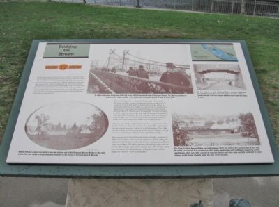
The first bridge ever to span the Mississippi River replaced the ferry in 1855. It was a wooden suspension bridge with a roadway only 17 feet wide. Territorial Governor Willis A. Gorman hailed the new bridge as a great step in opening the West, but its real importance lay in uniting the small milling communities of St. Anthony and Minneapolis. The towns merged in 1872, and four years later the original bridge was replaced with a sturdier structure. In 1890 a double steel-arch bridge of plain design was built and carried the growing burden of streetcars and commercial traffic for a hundred years.
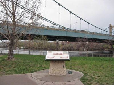
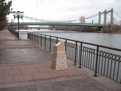
The present bridge on Hennepin Avenue, completed in 1990, is the fourth to cross the river at this spot. The suspension design was chosen as a salute to the first bridge. The 1990 bridge stands over the footings of the earlier bridges, which can be seen nearby, under the west end of the bridge.
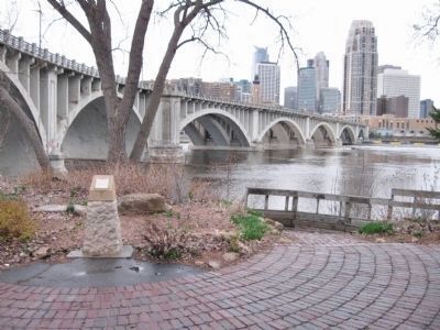
Downstream is the Third (Central) Avenue Bridge, completed in 1918, which reflects a time when city planners tried to soften the harshness of industrial society with a vision of gracious, cultivated urban landscapes. The same years saw broad boulevards laid out and the Minneapolis park system taking shape. The bridge's classic concrete arches, its wide walkways and pedestrian overlooks, suggest a vision of "The City Beautiful."
Erected by the St. Anthony Falls Heritage Board.
Topics. This historical marker is listed in these topic lists: Bridges & Viaducts • Waterways & Vessels. A significant historical year for this entry is 1850.
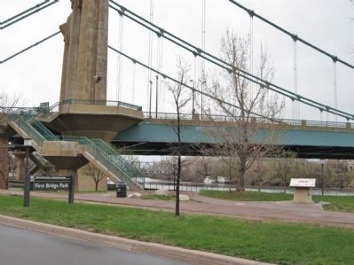
Location. 44° 59.071′ N, 93° 15.867′ W. Marker is in Minneapolis, Minnesota, in Hennepin County. It is in Central Minneapolis. Marker is on West River Parkway, 0.4 miles west of Portland Avenue South, on the right when traveling west. Marker is along a walking path in First Bridge Park. Touch for map. Marker is in this post office area: Minneapolis MN 55401, United States of America. Touch for directions.
Other nearby markers. At least 8 other markers are within walking distance of this marker. Stevens House (within shouting distance of this marker); The House of John H. Stevens (within shouting distance of this marker); Bridge Square to the Gateway (within shouting distance of this marker); Indians at the Falls (about 600 feet away, measured in a direct line); Father Louis Hennepin Bridge (about 600 feet away); William de la Barre (about 700 feet away); Nicollet Island Businesses (approx. 0.2 miles away); Joseph N. Nicollet (approx. 0.2 miles away). Touch for a list and map of all markers in Minneapolis.
More about this marker. [photo captions, clockwise from top]
• In 1890 a steel arch bridge was built next to the 1876 suspension bridge at Hennepin Avenue. The city was growing so quickly in the 1880s that the 1876 bridge was inadequate almost as soon as it was built.
• The first bridge to cross the Mississippi River is seen here looking west from Nicollet Island. This suspension bridge was built in 1855 by private interests. A toll was charged until the county bought the bridge in 1869.
• The Third (Central) Avenue Bridge was built between 1912 and 1918 in the classical style of the "City Beautiful" movement. It is seen here in 1917 under construction with scaffolding supporting curved steel beams which were later covered in concrete. Arches
and piers were carefully positioned to avoid damage to the fragile bedrock below the river at this location.
• Dakota Indians camped near what is now the western end of the Hennepin Avenue Bridge in the early 1850s. The roof visible in the background belonged to the house of ferryman John H. Stevens.
Also see . . . Hennepin Avenue Bridge. Wikipedia entry. (Submitted on December 6, 2011.)
Credits. This page was last revised on February 12, 2023. It was originally submitted on December 6, 2011, by Keith L of Wisconsin Rapids, Wisconsin. This page has been viewed 741 times since then and 20 times this year. Photos: 1, 2, 3, 4, 5. submitted on December 6, 2011, by Keith L of Wisconsin Rapids, Wisconsin.
