Brea in Orange County, California — The American West (Pacific Coastal)
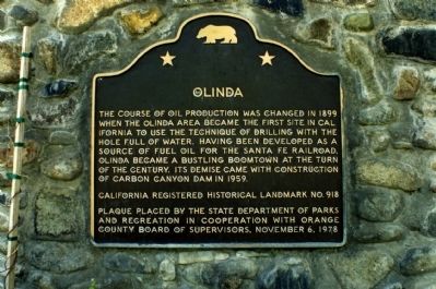
Olinda
Erected 1978 by State Department of Parks and Recreation in cooperation with Orange County Board of Supervisors. (Marker Number 918.)
Topics and series. This historical marker is listed in these topic lists: Natural Resources • Notable Places. In addition, it is included in the California Historical Landmarks series list. A significant historical year for this entry is 1899.
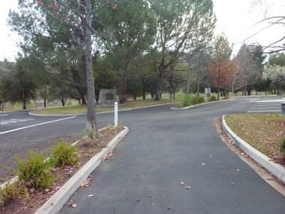
Location. 33° 55.276′ N, 117° 49.812′ W. Marker is in Brea, California, in Orange County. Marker is at the intersection of Carbon Canyon Road and Santa Fe Road, on the right when traveling east on Carbon Canyon Road. Marker is located in Carbon Canyon Regional Park. Touch for map. Marker is at or near this postal address: 4442 Carbon Canyon Road, Brea CA 92823, United States of America. Touch for directions.
Other nearby markers. At least 8 other markers are within 3 miles of this marker, measured as the crow flies. Olinda Historic Trail (approx. half a mile away); Olinda Oil Museum and Trail (approx. half a mile away); Pacific Electric Depot (approx. 2.2 miles away); Yorba Linda (approx. 2.3 miles away); Birthplace of Richard Milhous Nixon (approx. 2.3 miles away); Richard Nixon — A California Native Son (approx. 2.3 miles away); Richard Nixon (approx. 2.3 miles away); Richard Nixon Birthplace (approx. 2.3 miles away). Touch for a list and map of all markers in Brea.
More about this marker. This site has been designated as California Registered Historical Landmark No. 918.
Credits. This page was last revised on June 16, 2016. It was originally submitted on December 10, 2011, by Michael Kindig of Elk Grove, California. This page has been viewed 896 times since then and 42 times this year. Photos: 1. submitted on December 10, 2011, by Michael Kindig of Elk Grove, California. 2. submitted on May 5, 2013, by Mike Fay of Huntington Beach, California. • Syd Whittle was the editor who published this page.

