Near Ocotillo in Imperial County, California — The American West (Pacific Coastal)
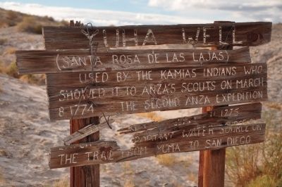
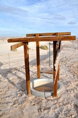
Yuha Well
(Santa Rosa de Las Lajas)
Topics and series. This historical marker is listed in these topic lists: Exploration • Native Americans. In addition, it is included in the Juan Bautista de Anza National Historic Trail series list. A significant historical month for this entry is March 1690.
Location. 32° 42.954′ N, 115° 52.622′ W. Marker is near Ocotillo, California, in Imperial County. Marker can be reached from Anza Trail Road. Marker is accessible by 4WD vehicles only. Anza Trail Road can be reached by the Yuba Cutoff (State Route 98) 11 miles east of the Town of Ocotillo. Touch for map. Marker is in this post office area: Ocotillo CA 92259, United States of America. Touch for directions.
Other nearby markers. At least 3 other markers are within 8 miles of this marker, measured as the crow flies. De Anza Overlook (approx. 2 miles away); Geoglyphs (approx. 7.2 miles away); Imperial Valley Desert Museum (approx. 7.2 miles away).
Credits. This page was last revised on June 16, 2016. It was originally submitted on December 10, 2011, by Michael Kindig of Elk Grove, California. This page has been viewed 982 times since then and 60 times this year. Photos: 1, 2, 3, 4. submitted on December 10, 2011, by Michael Kindig of Elk Grove, California. • Syd Whittle was the editor who published this page.


