Middleburg in Schoharie County, New York — The American Northeast (Mid-Atlantic)
Site of Middle Fort
(Fort Defiance)
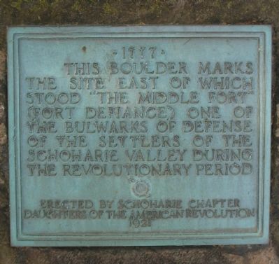
This Boulder Marks
The Site East of Which
Stood "The Middle Fort"
(Fort Defiance) One Of
The Bulwarks Of Defence
Of The Settlers Of The
Schoharie Valley During
The Revolutionary Period
Erected By Schoharie Chapter
Daughters Of The American Revolution
1921
Erected 1921 by Schoharie Chapter, Daughters Of The American Revolution.
Topics and series. This historical marker is listed in these topic lists: Forts and Castles • Patriots & Patriotism • War, US Revolutionary. In addition, it is included in the Daughters of the American Revolution series list. A significant historical year for this entry is 1921.
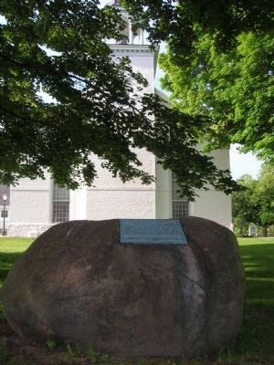
Location. 42° 36.318′ N, 74° 20.246′ W. Marker is in Middleburg, New York, in Schoharie County. Marker is on Middle Fort Street, on the right when traveling east. The marker is the shade of the trees on the lawn directly north of the Middleburg Reformed Church. Touch for map. Marker is in this post office area: Middleburgh NY 12122, United States of America. Touch for directions.
Other nearby markers. At least 8 other markers are within 2 miles of this marker, measured as the crow flies. A different marker also named Site of Middle Fort (about 400 feet away, measured in a direct line); Timothy Murphy (approx. half a mile away); Weiser's Dorf (approx. 0.6 miles away); 1st Reformed Church (approx. ¾ mile away); Hon. Jonathan Danforth Home (approx. 1.1 miles away); Burial Place (approx. 1.4 miles away); Indian Village (approx. 1½ miles away); Smoke Generator (approx. 1.6 miles away).
Regarding Site of Middle Fort. The Middle Fort - "About one-half mile east of the railroad depot, and a few rods to the left of the railway, as you approach Middleburg, stands the stone kitchen of the house of Johannes Becker, a "well-to-do" man at the time of the Revolution. Owing to its size and strength, and perhaps the interest felt by the proprietor, this building was selected as the "citadel " of the " Middle Fort " and which, tradition tells us, was enclosed, with two or three acres of land, by a stockade. Within the stockade, and around the Becker Mansion, were erected temporary barracks and dwellings for the troops sent from abroad to assist the home guards, and for the accommodation of the families living in the vicinity, during an expected invasion. Nothing remains of the Middle Fort today but a little stone kitchen. The imagination must create the rest. Here the "Bowld
Soger Buys" from the outside world came from time to time to show their military skill and buttons, eat the "kraut" and "liverwurst" provided by the "gutefraus," and flirt with the Low Dutch lassies. Within this stockade, Bartholomew C. Vroman espoused his cousin Susanna, and from its gate, Lieutenant Boyd went forth to meet the fulfillment of the curse pronounced upon him by the girl whom he had betrayed, and whose honor he refused to restore." From the text of "Military records of Schoharie County Veterans of Four Wars", 1891
Also see . . . Middle Fort (Fort Defiance). (Submitted on December 17, 2011, by Howard C. Ohlhous of Duanesburg, New York.)

Photographed By Howard C. Ohlhous, August 31, 2011
3. Site of Middle Fort Marker
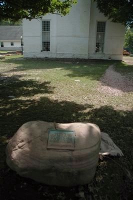
The dirt on the marker was left there by the flood waters of the Schoharie Creek after Hurricane Irene in late Ausgust 2011. The church in the background, along with much of the village of Middleburg, suffered severe damage from the flooding.
Credits. This page was last revised on June 16, 2016. It was originally submitted on December 17, 2011, by Howard C. Ohlhous of Duanesburg, New York. This page has been viewed 919 times since then and 33 times this year. Photos: 1, 2, 3. submitted on December 17, 2011, by Howard C. Ohlhous of Duanesburg, New York. • Bill Pfingsten was the editor who published this page.

