Ottawa in Franklin County, Kansas — The American Midwest (Upper Plains)
Pickrell Building
1885
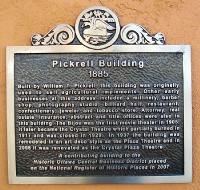
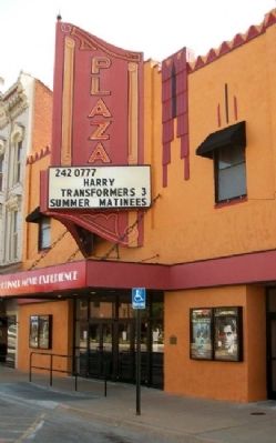
Built by William T. Pickrell, this building was originally used to sell agricultural implements. Other early businesses at this address included a millinery, barber shop, photography studio, billiard hall, restaurant, confectionary, jeweler and tobacco store. Attorney, real estate, insurance, abstract and title offices were also in this building. The Bijou was the first movie theater in 1905. It later became the Crystal Theatre which partially burned in 1917 and was closed in 1929. In 1937 the building was remodeled in an art deco style as the Plaza Theatre and in 2006 it was renovated as the Crystal Plaza Theatre.
A contributing building to the Historic Ottawa Central Business District placed on the National Register of Historic Places in 2007.
Topics and series. This historical marker is listed in these topic lists: Agriculture • Architecture • Industry & Commerce. In addition, it is included in the Art Deco series list. A significant historical year for this entry is 1905.
Location. 38° 36.918′ N, 95° 16.116′ W. Marker is in Ottawa, Kansas, in Franklin County. Marker is on Main Street near 2nd Street, on the left when traveling south. Touch for map. Marker is at or near this postal address: 209 South Main Street, Ottawa KS 66067, United States of America. Touch for directions.
Other nearby markers. At least 8 other markers are within walking distance of this marker. The Down Town Ottawa Historic District (a few steps from this marker); Shepherd & McQuesten Building (a few steps from this marker); Main Street, 200 Block South (within shouting distance of this marker); Franklin County Courthouse (about 400 feet away, measured in a direct line); a different marker also named The Franklin County Courthouse (about 700 feet away); Main Street, 400 Block South (approx. 0.2 miles away); Main Street, 500 Block South and City Park (approx. ¼ mile away); Marais de Cygnes River (approx. ¼ mile away). Touch for a list and map of all markers in Ottawa.
Also see . . . Historic Ottawa Central Business District National Register Nomination. (Submitted on December 19, 2011, by William Fischer, Jr. of Scranton, Pennsylvania.)
Credits. This page was last revised on January 19, 2021. It was originally submitted on December 19, 2011, by William Fischer, Jr. of Scranton, Pennsylvania. This page has been viewed 498 times since then and 18 times this year. Photos: 1, 2, 3. submitted on December 19, 2011, by William Fischer, Jr. of Scranton, Pennsylvania.


