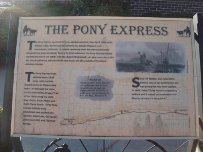
The Pony Express
The Pony Express route spanned some 1,823 miles, with stations located twelve to fifteen miles apart. In Nebraska the route mostly followed the Oregon Trail of the 1840s along the Little Blue, Platte, South Platte, and North Platte Rivers. Three Pony Express stations were established near present-day Ogallala: Alkali Lake, Gillís (also called Sand Hill), and Diamond Springs.
Sand Hill Station, also called Gillís Station, was of sod construction and was across the river from Ogallala. In 1865, Frank Young found it occupied by soldiers and it looked “as comfortless as a Siberian picture in a story-book.”
Erected by Ogallala/Keith County Chamber of Commerce. (Marker Number 4.)
Topics and series. This historical marker is listed in these topic lists: Communications
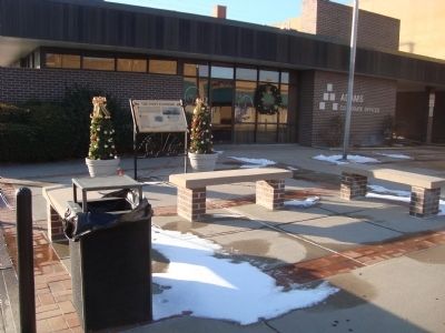
Location. 41° 7.548′ N, 101° 43.178′ W. Marker is in Ogallala, Nebraska, in Keith County. Marker is on North Spruce Street near West Second Street. This marker is located on the northwest corner of North Spruce Street and West Second Street in Ogallala, NE. It is marker no. 4 of the Historic Walk of Fame. Touch for map. Marker is at or near this postal address: 210 North Spruce Street, Ogallala NE 69153, United States of America. Touch for directions.
Other nearby markers. At least 8 other markers are within walking distance of this marker. Highways 26 and 92 (within shouting distance of this marker); California Hill (within shouting distance of this marker); Standard Oil Gas Station (within shouting distance of this marker); The Mormon Trail (within shouting distance of this marker); The Union Pacific (about 300 feet away, measured in a direct line); End of the Texas Trail (about 400 feet away); The Great Platte River Road (about 400 feet away); Interstate 80 (about 400 feet away). Touch for a list and map of all markers in Ogallala.
Also see . . . Pony Express - Wikipedia. (Submitted on December 20, 2011, by Barry Swackhamer of Brentwood, California.)
Additional keywords. Pony Express
Credits. This page was last revised on November 10, 2020. It was originally submitted on December 20, 2011, by Barry Swackhamer of Brentwood, California. This page has been viewed 1,142 times since then and 35 times this year. Photos: 1, 2. submitted on December 20, 2011, by Barry Swackhamer of Brentwood, California. • Bill Pfingsten was the editor who published this page.

