Martinez in Contra Costa County, California — The American West (Pacific Coastal)
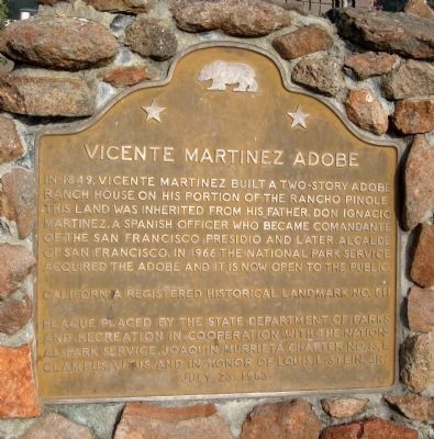
Vicente Martinez Adobe
Erected 1983 by State Department of Park and Recreation, National Park Service, Joaquin Murrieta Chapter No. 13, E Clampus Vitus. (Marker Number 511.)
Topics and series. This historical marker is listed in these topic lists: Hispanic Americans • Industry & Commerce • Settlements & Settlers. In addition, it is included in the California Historical Landmarks, the E Clampus Vitus, and the Juan Bautista de Anza National Historic Trail series lists. A significant historical year for this entry is 1849.
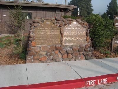
Location. 37° 59.526′ N, 122° 7.855′ W. Marker is in Martinez, California, in Contra Costa County. Marker can be reached from Alhambra Avenue, on the right when traveling south. Marker is located at the front of the visitor center at the John Muir National Historic Site. Touch for map. Marker is at or near this postal address: 4202 Alhambra Avenue, Martinez CA 94553, United States of America. Touch for directions.
Other nearby markers. At least 8 other markers are within 2 miles of this marker, measured as the crow flies. John Muir Home (here, next to this marker); National Treasures (a few steps from this marker); The Vicente Martinez Adobe - 1849 (approx. 0.2 miles away); 3220 Alhambra (approx. 0.6 miles away); The Christian Brothers Winery (approx. 1˝ miles away); Former Masonic Lodge Site (approx. 1.6 miles away); 1124 Ferry Street (approx. 1.6 miles away); Birthplace of The Martini (approx. 1.6 miles away). Touch for a list and map of all markers in Martinez.
More about this marker. This site and marker are located on the Juan Bautista de Anza National Historic Trail. See Nearby Marker "The Vicente Martinez Adobe - 1849" for additional information.
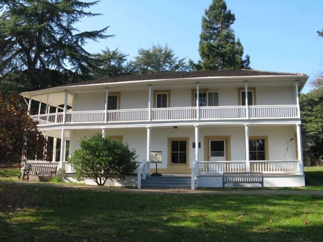
Regarding Vicente Martinez Adobe. The original land grant contained over 17,000 acres and reached the shore of San Francisco Bay about 8 miles to the west. Vicente Martinez built this house in 1849. The foundation is rough stone, while the walls are sun dried adobe bricks ranging from 24 to 30 inches thick. The roof was covered with either cedar or redwood shingles. Martinez lived in this adobe for four years. He sold it to Edward Franklin (namesake of the nearby Franklin Canyon) who had come to California from England during the early months of the Gold Rush.
Ownership changed several times
until purchased in 1874 by Dr. John Strentzel, father-in-law of John Muir. Dr. Strentzel used the adobe as a storeroom and as a residence for his ranch foreman.
In later years the adobe became the residence of John Muir’s eldest daughter, Wanda, and her husband Thomas Hanna.
Source: John Muir National Historic Site Tour Brochure
Credits. This page was last revised on July 27, 2018. It was originally submitted on December 21, 2011, by Syd Whittle of Mesa, Arizona. This page has been viewed 1,476 times since then and 28 times this year. Photos: 1, 2. submitted on December 21, 2011, by Syd Whittle of Mesa, Arizona. 3. submitted on December 22, 2011, by Syd Whittle of Mesa, Arizona.


