Hiawatha in Minneapolis in Hennepin County, Minnesota — The American Midwest (Upper Plains)
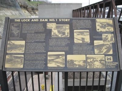
The Lock and Dam No. 1 Story
Navigation on this stretch of the river in its natural state upstream from St. Paul to Minneapolis was hazardous. During high flows, the current was swift, and during low flows, huge boulders made navigation almost impossible. It wasn't until after development of the locks and dams here that transport of flour and grain from Minneapolis to the Gulf of Mexico, and coal and bulk products from downriver to Minneapolis, became possible.
Development began when a group of Minneapolis businessmen led by a territorial judge formed the Mississippi River Improvement and Manufacturing Company for the purpose of obtaining permission to construct a lock and dam below St. Anthony Falls, on Meeker Island. Legislation was passed for this purpose in 1857.
The project was surrounded by controversy for the next 30 years with opinions being divided over its future implications. When it appeared that the company was unable to settle internal strife, the project was turned over to the Corps of Engineers. Meeker Island Dam, the final official Lock & Dam No. 2, a couple of miles upstream from here, became operational in May, 1907.
By this time, authorization had already been received from Congress (in 1899) to construct Lock and Dam No. 1 which was to eventually submerge the recently completed Lock and Dam No. 2 at Meeker Island.
Through the vigorous efforts of Major Schunk, the District Engineer, and local supporters, approval was received from Congress to alter the structure and plans for Lock and Dam No. 1 to enable production of hydro-electric generation. The height of the lock was increased to 30 feet in 1910 to allow for this.
On July 3, 1917, Lock and Dam No. 1, with hydro-electric capability of 15,200 horsepower, was opened for navigation. Six years after completion, a lease was negotiated with the Ford Motor Corporation for utilization of the dam's power capabilities.
Between 1917 and 1925, the upper pool was used primarily by pleasure craft; the main reason being the lack of adequate terminals and turning basins.
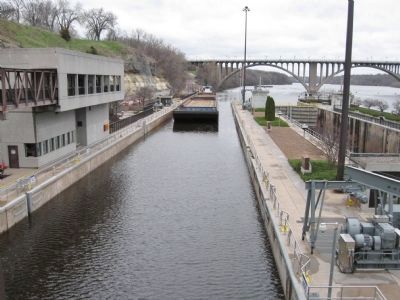
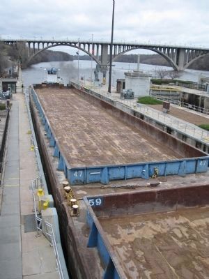
All barge traffic was halted in August 1929 when the lower lock gate failed. To ensure against future interruptions and in anticipation of a 9-foot channel between Minneapolis and St. Louis, the decision was made to build twin lock chambers. The first lock –– the riverward lock –– was completed in 1930 and the second –– the landward lock –– was placed into operation in 1932.
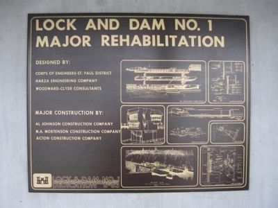
Lock and Dam No. 1 continued to serve the needs of people using the river for navigation along with supplying the capability for hydro-electric power. As the years passed the need arose for major rehabilitation
work to be done on the lock structure. Monies were appropriated and work began in 1976. Rehabilitation was completed in the summer of 1983.
Erected by US Army Corps of Engineers, St. Paul District.
Topics. This historical marker is listed in these topic lists: Industry & Commerce • Waterways & Vessels. A significant historical month for this entry is May 1907.
Location. 44° 54.849′ N, 93° 12.161′ W. Marker is in Minneapolis, Minnesota, in Hennepin County. It is in Hiawatha. Marker can be reached from Godfrey Road, 0.2 miles east of 46th Avenue South. Marker is at Lock and Dam No. 1. Touch for map. Marker is at or near this postal address: 5000 West River Parkway, Minneapolis MN 55417, United States of America. Touch for directions.
Other nearby markers. At least 8 other markers are within walking distance of this marker. Big Water / Stairway of Water (about 300 feet away, measured in a direct line); Wing Dams (about 300 feet away); Hydro Electric Turbine (approx. 0.2 miles away); Engineering the Mississippi / Ford Motor Company (approx. ¼ mile away); 3 – Master Map (approx. 0.3 miles away); 1–Main Entrance Minnehaha Lower Glen (approx. 0.3 miles away); Geology of Minnesota (approx. 0.3 miles away); John Harrington Stevens House (approx. 0.4 miles away). Touch for a list and map of all markers in Minneapolis.
More about this marker. [photo captions, clockwise from upper left corner]
• Map showing the location of Lock & Dam Nos. 1 and 2 in 1911. Note that the head of navigation is the Washington Avenue Bridge.
• Flooding in 1914 and 1916 caused work delays and damage to the high dam structure.
• Work on the High Dam nears completion; note the collardam surrounding the work area to prevent the river from flowing through.
• Failure of the lower gates along with anticipation of a 9-foot channel resulted in the building of the twin lock chambers.
• Excavation for the center lock wall and the new landward lock chambers began in 1929.
• Locking through the new chamber, heading up river towards the Ford Bridge, in 1930.
• An August 1939 photo of the completed lock chambers, with the 9-foot channel.
• Work on Lock & Dam No. 1 was completed in 1917 while construction continued on the hydroelectric plant on the right bank of the river.
• The increase from a 3 ft. to a 6 ft. channel required lowering the floor of the lock chamber; photo is approximately 1911.
• Beginnings of the lock chamber of Lock & Dam No. 1 on May 22, 1907.
Also see . . . Lock and Dam No. 1. Wikipedia entry. (Submitted on December 25, 2011.)
Credits. This page was last revised on February 12, 2023. It was originally submitted on December 25, 2011, by Keith L of Wisconsin Rapids, Wisconsin. This page has been viewed 728 times since then and 21 times this year. Last updated on March 16, 2019, by McGhiever of Minneapolis, Minnesota. Photos: 1, 2, 3, 4, 5, 6, 7, 8, 9, 10. submitted on December 25, 2011, by Keith L of Wisconsin Rapids, Wisconsin. • Bill Pfingsten was the editor who published this page.
