Torresdale in Philadelphia in Philadelphia County, Pennsylvania — The American Northeast (Mid-Atlantic)
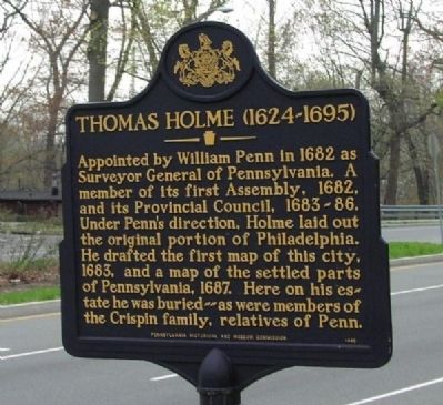
Thomas Holme (1624-1695)
Erected 1995 by Pennsylvania Historical and Museum Commission.
Topics and series. This historical marker is listed in these topic lists: Cemeteries & Burial Sites • Colonial Era • Settlements & Settlers. In addition, it is included in the Pennsylvania Historical and Museum Commission series list. A significant historical year for this entry is 1682.
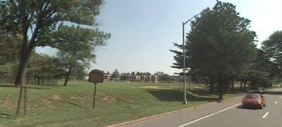
Location. 40° 3.399′ N, 75° 1.277′ W. Marker is in Philadelphia, Pennsylvania, in Philadelphia County. It is in Torresdale. Marker is at the intersection of Holme Avenue and Longford Street, on the right when traveling west on Holme Avenue. Touch for map. Marker is at or near this postal address: 10 Longford St, Philadelphia PA 19136, United States of America. Touch for directions.
Other nearby markers. At least 8 other markers are within 3 miles of this marker, measured as the crow flies. Greenbelt Knoll (about 300 feet away, measured in a direct line); Pennypack Creek Bridge (approx. 0.9 miles away); Torresdale (approx. 1.6 miles away); Tidal Delaware Water Trail (approx. 1.9 miles away); Poquessing Creek (approx. 2.1 miles away); Torresdale / Holmesburg (approx. 2.1 miles away); Glen Foerd on the Delaware (approx. 2.2 miles away); Pennepack Baptist Church (approx. 2.3 miles away). Touch for a list and map of all markers in Philadelphia.
Related markers. Click here for a list of markers that are related to this marker.
Also see . . . Thomas Holme - Wikipedia. (Submitted on December 27, 2011, by Keith S Smith of West Chester, Pennsylvania.)
Credits. This page was last revised on February 2, 2023. It was originally submitted on December 27, 2011, by Keith S Smith of West Chester, Pennsylvania. This page has been viewed 813 times since then and 31 times this year. Photos: 1, 2. submitted on December 27, 2011, by Keith S Smith of West Chester, Pennsylvania. • Bill Pfingsten was the editor who published this page.

