San Diego in San Diego County, California — The American West (Pacific Coastal)
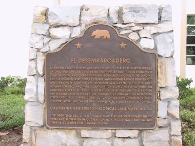
El Desembarcadero
Erected 1996 by State Department of Parks and Recreation in cooperation with the U.S. Navy and Squibob Chapter, E Clampus Vitus. (Marker Number 64.)
Topics and series. This historical marker is listed in these topic lists: Industry & Commerce • Waterways & Vessels. In addition, it is included in the California Historical Landmarks, and the E Clampus Vitus series lists. A significant historical month for this entry is April 1770.
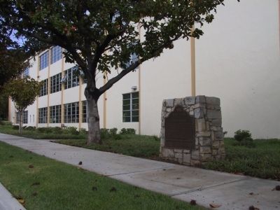
Location. 32° 44.054′ N, 117° 13.206′ W. Marker is in San Diego, California, in San Diego County. Marker is on Farragut Road east of Rosecrans Street, on the right when traveling east. Touch for map. Marker is at or near this postal address: 2969 Farragut Road, San Diego CA 92106, United States of America. Touch for directions.
Other nearby markers. At least 8 other markers are within walking distance of this marker. North Chapel, Building 208 (approx. 0.4 miles away); Command Center, Building 200 (approx. 0.4 miles away); Library Building 177 (approx. 0.4 miles away); Ingram Plaza (approx. 0.4 miles away); USS Recruit (approx. half a mile away); Gun Platform No. 1 - 1945 (approx. half a mile away); a different marker also named Ingram Plaza (approx. half a mile away); Gun Platform No. 2 - 1945 (approx. half a mile away). Touch for a list and map of all markers in San Diego.
Regarding El Desembarcadero. El Desembarcadero was one of the first landmarks designated during the first year of the landmark program. The site was recognized as the landing place for small boats carrying freight and passengers to Old San Diego. It was also believed to be the place visited in 1769 by the crews of the San Antonio and San Carlos in their search for fresh water. SOURCE: California Historical Landmarks, California State Parks
Credits. This page was last revised on June 16, 2016. It was originally submitted on December 29, 2011, by Michael Kindig of Elk Grove, California. This page has been viewed 621 times since then and 19 times this year. Photos: 1. submitted on December 30, 2011, by Michael Kindig of Elk Grove, California. 2. submitted on January 4, 2012, by Michael Kindig of Elk Grove, California. • Syd Whittle was the editor who published this page.

