Library District in Kansas City in Jackson County, Missouri — The American Midwest (Upper Plains)
Camp Union
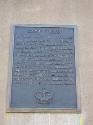
In June – July, 1861, barracks and service buildings within a 200-foot-square earthwork were built on this site by the battalion of United States Reserve Corps, Companies A, B, and C, organized by Major R. T. Van Horn, then Mayor of the City. By these means Kansas City was held to the Union throughout the Civil War while border fighting harassed the county. The cellars of the unfinished Coates Hotel on the west were used as cavalry barns.
Erected 1957 by Native Sons of Kansas City.
Topics and series. This historical marker is listed in these topic lists: Forts and Castles • War, US Civil. In addition, it is included in the Kansas City - Native Sons and Daughters of Greater Kansas City series list. A significant historical year for this entry is 1861.
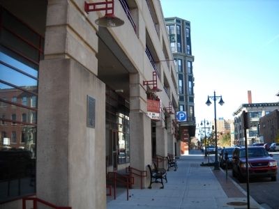
Location. 39° 6.132′ N, 94° 35.227′ W. Marker is in Kansas City, Missouri, in Jackson County. It is in the Library District. Marker is on Tenth Street, 0.1 miles west of Central Avenue, on the right when traveling east. Touch for map. Marker is in this post office area: Kansas City MO 64105, United States of America. Touch for directions.
Other nearby markers. At least 8 other markers are within walking distance of this marker. First Meeting of Sertoma International (about 300 feet away, measured in a direct line); J. Fitzpatrick Saloon Building (about 300 feet away); Frankel, Frank & Co Building (about 400 feet away); Rothenberg and Schloss Building (about 400 feet away); Hershberger & Rosenthal Co. Bldg. (about 500 feet away); Jay and King Hat Co Building (about 500 feet away); Liebstadter Millinery Company Building (about 500 feet away); Missouri Interstate Paper Company Building (about 500 feet away). Touch for a list and map of all markers in Kansas City.
More about this marker. Metered parking available on street. Marker is to the east of the Quality Hill Playhouse.
Also see . . .
1. R. T. Van Horn. Wikipedia link on Robert Van Horn (Submitted on December 31, 2011, by Thomas Onions of Olathe, Kansas.)
2. Coates House. Exploring Kansas City Examiner Article on the Historic Coates House. (Submitted on December 31, 2011, by Thomas Onions of Olathe, Kansas.)
3. Kansas City Convention Bureau. (Submitted on December 31, 2011, by Thomas Onions of Olathe, Kansas.)
Credits. This page was last revised on February 10, 2023. It was originally submitted on December 31, 2011, by Thomas Onions of Olathe, Kansas. This page has been viewed 814 times since then and 18 times this year. Photos: 1, 2. submitted on December 31, 2011, by Thomas Onions of Olathe, Kansas.

