Purple Heart
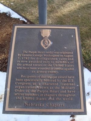
Recipients of this unique award have been specifically honored by the U.S. Congress as a chartered fraternal organization known as the Military Order of the Purple Heart and have active members in chapters throughout the United States and the world.
Nebraska Chapters.
Topics and series. This historical marker is listed in this topic list: Military. In addition, it is included in the Military Order of the Purple Heart series list. A significant historical year for this entry is 1782.
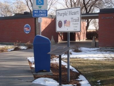
Location. 41° 6.424′ N, 101° 45.408′ W. Marker is in Ogallala, Nebraska, in Keith County. Marker is on Interstate 80, on the right when traveling east. This marker is located at the Ogallala Rest Stop on Interstate 80. The rest stop is on the south side of the highway while heading east. Touch for map. Marker is in this post office area: Ogallala NE 69153, United States of America. Touch for directions.
Other nearby markers. At least 8 other markers are within 3 miles of this marker, measured as the crow flies. Chain – O – Lakes (within shouting distance of this marker); Samuel David “Lep” Sanders (approx. 1˝ miles away); Oregon Trail (approx. 1.9 miles away); Sand Hill Station
Also see . . . Purple Heart - Wikipedia. (Submitted on January 2, 2012, by Barry Swackhamer of Brentwood, California.)
Credits. This page was last revised on June 16, 2016. It was originally submitted on January 2, 2012, by Barry Swackhamer of Brentwood, California. This page has been viewed 728 times since then and 27 times this year. Photos: 1, 2. submitted on January 2, 2012, by Barry Swackhamer of Brentwood, California. • Bill Pfingsten was the editor who published this page.

