Near San Bernardino in San Bernardino County, California — The American West (Pacific Coastal)
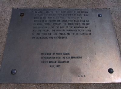
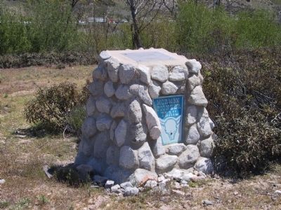
Mormon Pioneer Trail
Erected 1985 by Aaron Rogers in association with the San Bernardino County Museum Association.
Topics and series. This historical marker is listed in these topic lists: Notable Places • Roads & Vehicles • Settlements & Settlers. In addition, it is included in the Mormon Pioneer Trail series list. A significant historical month for this entry is June 1851.
Location. 34° 18.165′ N, 117° 27.957′ W. Marker is near San Bernardino, California, in San Bernardino County. Marker can be reached from Interstate 15. Marker is located approximately 500 feet south of southbound Interstate 15 at the Elsie Arey May Nature Center. Touch for map. Marker is in this post office area: Phelan CA 92371, United States of America. Touch for directions.
Other nearby markers. At least 8 other markers are within 3 miles of this marker, measured as the crow flies. Stoddard-Waite Monument (about 300 feet away, measured in a direct line); Santa Fe and Salt Lake Trail (approx. ¼ mile away); Welcome to Camp Cajon (approx. ¼ mile away); Camp Cajon Monument (approx. ¼ mile away); Hill 582 (approx. 2.2 miles away); Blue Cut (approx. 2½ miles away); Summit Train Station (approx. 3 miles away); Elliot Ranch (approx. 3 miles away).
More about this marker. Special permission from the San Bernardino County Museum is required to visit this site.
Credits. This page was last revised on August 20, 2023. It was originally submitted on January 2, 2012, by Michael Kindig of Elk Grove, California. This page has been viewed 1,606 times since then and 57 times this year. Photos: 1, 2. submitted on January 2, 2012, by Michael Kindig of Elk Grove, California. • Syd Whittle was the editor who published this page.

