Leesburg in Loudoun County, Virginia — The American South (Mid-Atlantic)
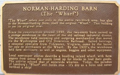
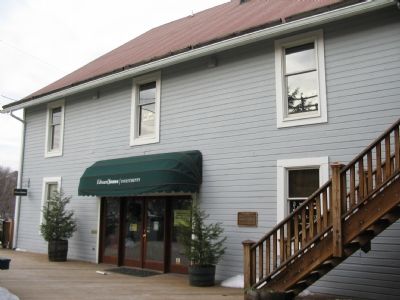
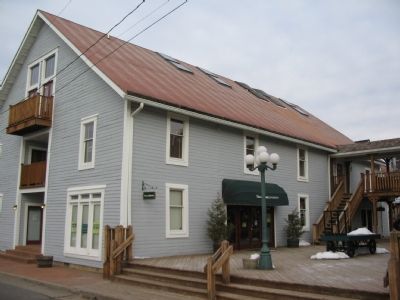
Norman-Harding Barn
(The "Wharf")
Since its construction around 1890, the two-story barn served as a storage warehouse in the heart of the old railroad industrial district. The warehouse held incoming and outgoing merchandise that moved via the Washington and Old Dominion Railroad. Salted herrings, a seasonal specialty from Tidewater, Virginia, came by the barrel for sale to purchasers at the Wharf. By the 1920's, the warehouse held farm machinery, as well as wagons, buggies and other equipment.
Local newspaper stories describe a bustling inland wharf, with farm wagons from across the county lined up for blocks to load their goods. The activity echoed that of waterside wharves. Today, the paradox of Leesburg's "Wharf" still holds true - it's dry as a bone and never berthed a ship!
Topics and series. This historical marker is listed in these topic lists: Industry & Commerce • Railroads & Streetcars. In addition, it is included in the Washington and Old Dominion (W&OD) Railroad series list. A significant historical year for this entry is 1890.
Location. 39° 6.744′ N, 77° 33.803′ W. Marker is in Leesburg, Virginia, in Loudoun County. Marker is at the intersection of South Street and Harrison Street, on the right when traveling west on South Street. Touch for map. Marker is in this post office area: Leesburg VA 20175, United States of America. Touch for directions.
Other nearby markers. At least 8 other markers are within walking distance of this marker. Log House (a few steps from this marker); Dairy Barn (a few steps from this marker); Stationmaster's House (within shouting distance of this marker); McKimmey's Mill (within shouting distance of this marker); Osterburg Mill (within shouting distance of this marker); The Depot (within shouting distance of this marker); The Tolbert Building (about 400 feet away, measured in a direct line); The Orion Anderson Story (about 600 feet away). Touch for a list and map of all markers in Leesburg.
Also see . . .
1. The Washington and Old Dominion Railroad. Book by Ames Williams available on Amazon.com (Submitted on May 7, 2008, by Tom Fuchs of Greenbelt, Maryland.)
2. Rails to the Blue Ridge: The Washington and Old Dominion Railroad, 1847 - 1968. Book by Herbert Harwood available on Amazon.com (Submitted on May 7, 2008, by Tom Fuchs of Greenbelt, Maryland.)
Credits. This page was last revised on June 16, 2016. It was originally submitted on February 3, 2008, by Craig Swain of Leesburg, Virginia. This page has been viewed 2,247 times since then and 18 times this year. Photos: 1, 2, 3. submitted on February 3, 2008, by Craig Swain of Leesburg, Virginia.


