Shoreacres in La Porte in Harris County, Texas — The American South (West South Central)
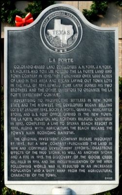
La Porte
Advertising to prospective settlers in New York State and the Midwest, the developers began selling lots by January 1892. Soon a hotel, general mercantile store, and U.S. Post Office opened in the new town. The La Porte, Houston, and Northern Railroad, chartered in 1892, completed a line to Sylvan Beach Resort in 1899. Along with agriculture, the beach became the town's main economic mainstay.
The original investment company became insolvent by 1895, but a new company purchased the land in 1898 and continued development efforts. Disastrous effects of the 1900 storm, as well as another storm and a fire in 1915, the discovery of the Goose Creek oil field in 1916, and the industrialization of the area following World War II, resulted in an increased population and a shift away from the agricultural character of the town.
Erected 1992 by Texas Historical Commission. (Marker Number 10715.)
Topics. This historical marker is listed in this topic list: Settlements & Settlers. A significant historical month for this entry is January 1892.
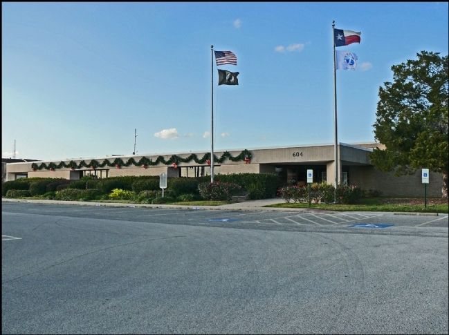
Location. 29° 39.165′ N, 95° 1.47′ W. Marker is in La Porte, Texas, in Harris County. It is in Shoreacres. Marker is at the intersection of West Fairmont Parkway and South 6th Street, on the right when traveling west on West Fairmont Parkway. Touch for map. Marker is at or near this postal address: 604 W Fairmont Pkwy, La Porte TX 77571, United States of America. Touch for directions.
Other nearby markers. At least 8 other markers are within 2 miles of this marker, measured as the crow flies. The La Porte-Sylvan Beach Depot (approx. 0.7 miles away); La Porte's Original Library (approx. 0.7 miles away); Sylvan Beach Pavilion (approx. 0.8 miles away); First City Hall and Jail (approx. 0.9 miles away); Besson Building (approx. 0.9 miles away); Saint Mary's Seminary (approx. 0.9 miles away); Five Points - The Hub of the City (approx. 0.9 miles away); John A. Grimes Memorial Park (approx. 1.7 miles away). Touch for a list and map of all markers in La Porte.
Also see . . . La Porte in the Handbook of Texas. (Submitted on May 19, 2019, by Jim Evans of Houston, Texas.)
Credits. This page was last revised on February 1, 2023. It was originally submitted on January 8, 2012, by Jim Evans of Houston, Texas. This page has been viewed 950 times since then and 32 times this year. Photos: 1, 2. submitted on January 8, 2012, by Jim Evans of Houston, Texas. • Bernard Fisher was the editor who published this page.

