Near Manning in Clarendon County, South Carolina — The American South (South Atlantic)
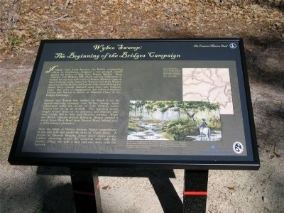
Wyboo Swamp:
The Beginning of the Bridges Campaign
Inscription.
In March 1781, Lord Francis Hastings Rawdon, the British commanding officer in Charleston, designed a two-pronged assault against the forces of General Francis Marion. From Camden, Col. Welbore Ellis Doyle and the Volunteers of Ireland moved east and south to destroy Marion’s camp at Snow’s Island, while from Fort Watson, Col. John Watson and a combined British and Loyalist force moved along the Santee River towards Marion’s main force near Nelson’s Ferry. The series of engagements that followed between Watson and Marion is known as Watson’s Chase or the Bridges Campaign.
Marion and Watson first clashed on March 6 on the quarter-mile-long causeway over Wyboo Swamp (today submerged under the waters of Lake Marion), where Marion had set up an ambush. The opposing cavalry fought several times on the causeway, and Marion’s men were initially able to hold back Watson’s advance.
When two British cannons arrived, however, Marion ordered a retreat down River Road (now Patriot Road, behind you) to John Cantey’s plantation.
After the battle at Wyboo Swamp, Patriot sympathizers in the area told and retold the story of Gavin James.
A
private in Marion’s Bridage, James faced down enemy
soldiers advancing across the causeway with only his
musket, felling one with a shot and two more with his
bayonet.
Erected
Topics and series. This historical marker is listed in these topic lists: Education • Patriots & Patriotism • War, US Revolutionary. In addition, it is included in the Francis Marion Trail series list. A significant historical month for this entry is March 1781.
Location. 33° 32.368′ N, 80° 13′ W. Marker is near Manning, South Carolina, in Clarendon County. Marker is at the intersection of Patriot Road (State Highway 14-410) and Wyboo Road on Patriot Road. Touch for map. Marker is in this post office area: Manning SC 29102, United States of America. Touch for directions.
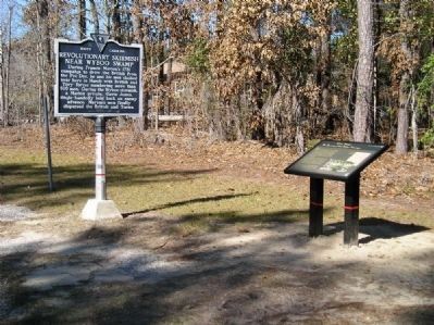
Other nearby markers. At least 8 other markers are within 9 miles of this marker, measured as the crow flies. Revolutionary Skirmish Near Wyboo Swamp (here, next to this marker); Mt. Zion A.M.E. Church (approx. 1.7 miles away); Pearson Family Homesite/ Pearson V. Clarendon Co. (approx. 4.1 miles away); Cantey Family Cemetery (approx. 7.4 miles away); Taw Caw Church (approx. 8.3 miles away); The Patriot and the Redcoat (approx. 9 miles away); Summerton Presbyterian Church (approx. 9 miles away); Siege of Fort Watson (approx. 9 miles away).
Related markers. Click here for a list of markers that are related to this marker. To better understand the relationship, study each marker shown.
Additional commentary.
1. New Clarendon County Tour app
Find all the Clarendon County history markers the easy way, hear the text & see the maps, just download the Clarendon County tour app onto your phone, https://play.google.com/store/apps/details?id=com.brinkman.ClarendonTour
— Submitted August 8, 2013, by C Summers of Manning, South Carolina.
Credits. This page was last revised on June 16, 2016. It was originally submitted on January 26, 2012, by C Summers of Manning, South Carolina. This page has been viewed 1,669 times since then and 40 times this year. Photos: 1, 2. submitted on January 26, 2012, by C Summers of Manning, South Carolina. • Bill Pfingsten was the editor who published this page.

