Manning in Clarendon County, South Carolina — The American South (South Atlantic)
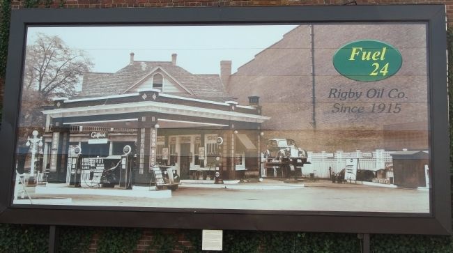
Fuel 24
Rigby Oil Co. Since 1915
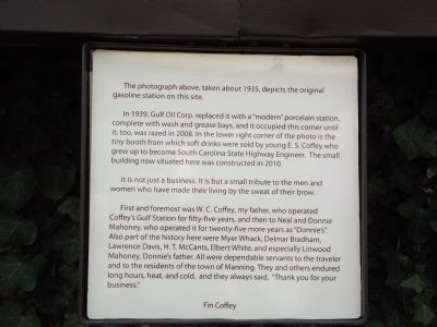
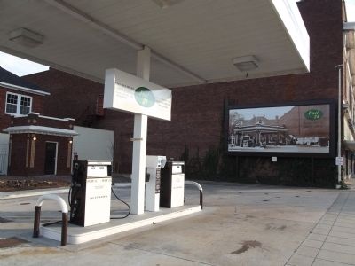
In 1939, Gulf Oil Corp. replaced it with a “modern” porcelain station, complete with wash and grease bays, and it occupied this corner until it, too, was razed in 2008. In the lower right corner of the photo is the tiny booth from which soft drinks were sold by young E. S. Coffey who grew up to become South Carolina State Highway Engineer. The small building now situated here was constructed in 2010.
It is not just a business. It is but a small tribute to the men and women who have made their living by the sweat of their brow.
First and foremost was W.C. Coffey, my father, who operated Coffey’s Gulf Station for fifty-five years, and then to Neal and Donnie Mahoney, who operated it for twenty-five more years as “Donnie’s”. Also part of the history here were Myer Whack, Delmar Bradham, Lawrence Davis, H.T. McCants, Elbert White, and especially Linwood Mahoney, Donnie’s father. All were dependable servants to the traveler and to the residents of the town of Manning. They and others endured long hours, heat, and cold, and they always said, “Thank you for your business.”
Fin Coffey
Erected by Fin Coffey.
Topics. This historical marker is listed in this topic list: Industry & Commerce. A significant historical year for this entry is 1935.
Location. 33° 41.792′ N, 80° 12.637′ W. Marker is in Manning, South Carolina, in Clarendon County. Marker is at the intersection of East Rigby Street and North Brooks Street, on the left when traveling west on East Rigby Street. Touch for map. Marker is in this post office area: Manning SC 29102, United States of America. Touch for directions.
Other nearby markers. At least 8 other markers are within walking distance of this marker. The Swamp Fox (within shouting distance of this marker); Ambush at Half-Way Swamp (within shouting distance of this marker); Murray's Ferry - Santee River (about 300 feet away, measured in a direct line); Francis Marion Reflections (about 300 feet away); Pond Bluff to St Stephens (about 400 feet away); Trinity A.M.E. Church (about 500 feet away); Clarendon County Veterans Memorial (about 600 feet away); Clarendon County Confederate Monument (about 600 feet away). Touch for a list and map of all markers in Manning.
Credits. This page was last revised on June 16, 2016. It was originally submitted on February 5, 2012, by Anna Inbody of Columbia, South Carolina. This page has been viewed 806 times since then and 27 times this year. Photos: 1, 2, 3, 4. submitted on February 5, 2012, by Anna Inbody of Columbia, South Carolina. • Craig Swain was the editor who published this page.


