Bear Mountain in Rockland County, New York — The American Northeast (Mid-Atlantic)
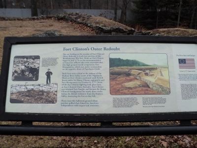
Fort Clinton’s Outer Redoubt
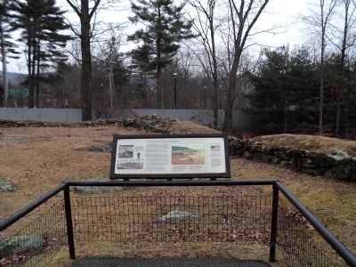
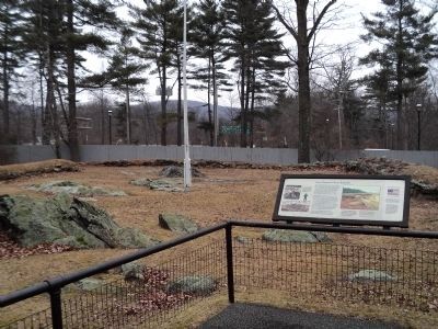
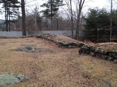
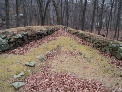
You are looking at the remains of Fort Clinton’s Outer Redoubt; it is all that survives of this Revolutionary War fort. Work on Fort Clinton began in July 1776 on the recommendation of American officers who were concerned that this high ground would compromise Fort Montgomery, which was under construction on the opposite shore of Popolopen Creek.
Both forts were critical to the defense of the Hudson River Valley north of the Highlands. Work on Fort Clinton continued until British forces under Sir Henry Clinton captured it and Fort Montgomery on October 6, 1777. Some of the day’s fiercest fighting took place here, at Fort Clinton’s Outer Redoubt. Fort Clinton was renamed Fort Vaughn and became Sir Henry Clinton’s headquarters for nearly three weeks before the British withdrew from the Hudson Valley, destroying the fort as they left.
Please treat this hallowed ground where patriots spilled their blood for American independence with respect and reverence.
< Sidebar : >
The First Stars and Stripes
On June 14, 1777, Congress resolved:
“That the flag of the thirteen United
States be thirteen stripes, alternate
red and white; that the union be
thirteen stars, white on a blue field,
representing a new constellation.”
Congress did not specify how the stars should be arranged, so different patterns emerged. The flag with thirteen stars in a circle is sometimes called “The First Stars and Stripes” and is also commonly called the “Betsy Ross” flag, referring to the legend that she designed and made the first U.S. flag. The first recorded use of the new flag was at Fort Schuyler (Stanwix) in August 1777, when British General Barry St. Leger besieged the fort. It is possible, therefore, that the new American flag flew above Fort Clinton when the British attacked on October 6, 1777.
Erected by State of New York.
Topics. This historical marker is listed in these topic lists: Forts and Castles • War, US Revolutionary. A significant historical date for this entry is June 14, 1777.
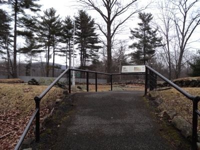
Location. 41° 19.171′ N, 73° 59.373′ W. Marker is in Bear Mountain, New York, in Rockland County. Marker can be reached from New York State Route 9 W, on the right when traveling north. Marker is located on a walking trail through the zoo at Bear Mountain. Touch for map. Marker is in this post office area: Bear Mountain NY 10911, United States of America. Touch for directions.
Other nearby markers. At least 8 other markers are within walking distance of this marker. Outer Redoubt of Fort Clinton (a few steps from this marker); The British Attempt to Divide the Colonies during the War of Independence (a few steps from this marker); The West Redoubt of Fort Clinton
(a few steps from this marker); Appalachian Trail (within shouting distance of this marker); a different marker also named Appalachian Trail (within shouting distance of this marker); Fort Clinton (about 300 feet away, measured in a direct line); The Historic 1777 & 1779 Trails (about 400 feet away); Bear Mountain Bridge (about 400 feet away). Touch for a list and map of all markers in Bear Mountain.
More about this marker. Two photographs of archeological work being done at Fort Clinton appear on the left of the marker. These have the caption “In 1935 and 1936, staff at the Trailside Museums conducted archeological excavations of the Outer Redoubt, which had been spared destruction when the Bear Mountain Bridge was built a decade earlier. They recovered hundreds of musket balls that were evidence of the fierce battle that took place here.”
.
A colonial flag appears as part of the sidebar.
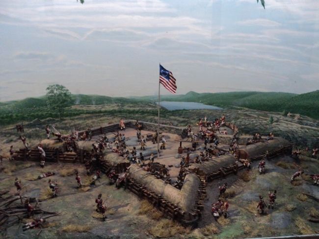
The right side of the marker features a picture of soldiers in the Outer Redoubt of Fort Clinton. It has a caption of “About 90 men of the Second Regiment of the Ulster County Militia under Colonel James McClaghry, and another 9 artillerymen, defended Fort Clinton’s Outer Redoubt. According to one of McClarghy’s captains, this was hardly half the men necessary to line the walls of the redoubt with a single rank. One column of British soldiers attacked the main part of Fort Clinton, while another column advanced through a hollow to within 200 feet of the Outer Redoubt.
After ‘a warm fire ensued between them and the redoubt,’ this column withdrew to the protection of the hollow until the main part of the Fort Clinton was captured. Then both columns attacked the Outer Redoubt. The Americans made a desperate last stand, repulsing the first assault before the British finally swept over the walls.
Illustration of the Outer Redoubt, by Jack Mead.”
Also see . . . The Battle of Fort's (sic) Montgomery and Clinton. The American Revolutionary War website entry (Submitted on February 16, 2012, by Bill Coughlin of Woodland Park, New Jersey.)
Credits. This page was last revised on August 21, 2021. It was originally submitted on February 16, 2012, by Bill Coughlin of Woodland Park, New Jersey. This page has been viewed 853 times since then and 24 times this year. Photos: 1, 2, 3, 4, 5, 6. submitted on February 16, 2012, by Bill Coughlin of Woodland Park, New Jersey. 7. submitted on February 17, 2012, by Bill Coughlin of Woodland Park, New Jersey.
