Near Reads Landing in Wabasha County, Minnesota — The American Midwest (Upper Plains)
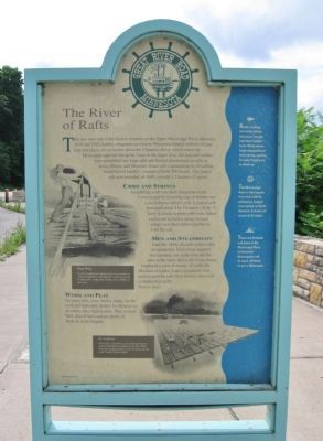
The River of Rafts
— Great River Road Minnesota —
Cribs and Strings
Assembling a raft was hard, dangerous work. Crews began by fastening logs or lumber into a wood frame called a crib. A typical crib measured about 5 by 10 meters (16 by 32 feet). A dozen or more cribs were linked end to end to form a string; several strings were then lashed together to form the raft.
Men and Steamboats
Until the 1860s, the rafts relied solely on manpower. Each string required two oarsmen, one at the bow and the other at the stern; thus a raft of ten strings employed a crew of twenty, all under the direction of a pilot. Later, steamboats were used to push the rafts from behind, often with a smaller boat at the front to steer.
Work and Play
On some rafts, crews built a shanty for the cook and makeshift shelters for themselves; on others, they slept in tents. They worked hard, played hard, and got plenty of fresh air in the bargain.
Illustrations by Bill Cannon
[reverse side]
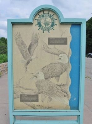
Eagles Aloft
This is a prime area for viewing bald eagles. They are drawn here all winter long by open water and an abundant supply of fish. Eagles build their nests near the water in the water in the tops of tall trees.
Majestic Birds
Bald eagles are easily identified, even in flight, by their white heads and tails. A mature bald eagle can have a wingspan of 200 centimeters (80 inches). Minnesota has the third largest bald eagle population in the United States.
Illustrations by Vera Wong
"Pearched Eagles" Courtesy Minnesota Department of Natural Resources
1988, State of Minnesota, Department of Natural Resources
Erected 1988 by Minnesota Department of Natural Resource Great River Road marker program.
Topics and series. This historical marker is listed in these topic lists: Animals • Industry & Commerce • Waterways & Vessels. In addition, it is included in the Minnesota Great River Road series list. A significant historical year for this entry is 1830.
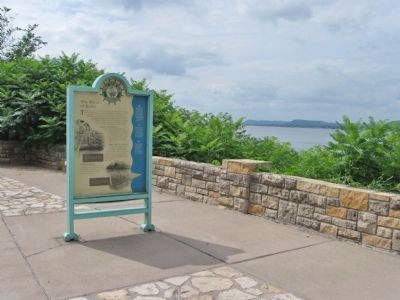
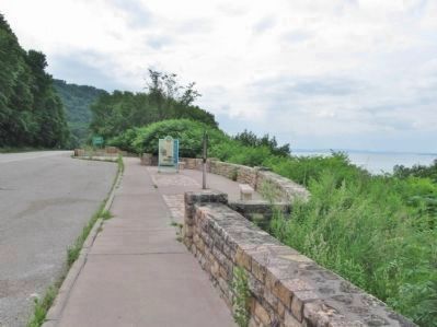
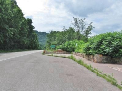
Location. 44° 24.607′ N, 92° 6.451′ W. Marker is near Reads Landing, Minnesota, in Wabasha County. Marker is on Great River Road (U.S. 61) 1˝ miles north of 9th Avenue, on the right when traveling north. Marker is along the roadside at the Reads Landing / Lake Pepin Scenic Overlook. Touch for map. Marker is in this post office area: Lake City MN 55041, United States of America. Touch for directions.
Other nearby markers. At least 8 other markers are within 5 miles of this marker, measured as the crow flies. Lake Pepin (a few steps from this marker); a different marker also named Lake Pepin (within shouting distance of this marker); Anchor from the "Phil Scheckel" (approx. 3.2 miles away in Wisconsin); Laura Ingalls Wilder (approx. 3.2 miles away in Wisconsin); The Bridge (approx. 4 miles away); Wapahasha I / Wapahasha II / Wapahasha III (approx. 4.2 miles away); Veterans Memorial (approx. 4.2 miles away); Grace Memorial Episcopal Church (approx. 4.2 miles away). Touch for a list and map of all markers in Reads Landing.
More about this marker.
[illustration captions]
• Hard Work · It took strength and stamina to be an oarsman on a Mississippi River raft. But life on the river had its pleasures - especially if there was a fiddler in the crew.
• On the River · Pushed by a steamboat, a big raft heads downstream from Reads Landing in the late 1860s. Note the sleeping shelters near the front and the cook's shanty in
the middle.
[right panel]
• Reads Landing, two miles below this point, was an important lumber town. Many steamboats stopped there each spring, waiting for Lake Peppin's ice to break up.
• The Mississippi River is the longest river and, with its tributaries, largest river system in North America. It drains all or part of 31 states.
• There are 29 locks and dams in the Mississippi River, all between Minneapolis and St. Louis. Of these, 11 are in Minnesota.
Also see . . .
1. Timber rafting. Wikipedia entry. (Submitted on February 17, 2012.)
2. Minnesota Department of Transportation. Historic Roadside Development Structures Inventory. "Built into the western end of the overlook wall is another stone shrine-type marker. It has a short square pedestal (rather than a tall shaft) that is flanked by stepped sidewalls..." (Submitted on February 17, 2012.)
Credits. This page was last revised on June 16, 2016. It was originally submitted on February 17, 2012, by Keith L of Wisconsin Rapids, Wisconsin. This page has been viewed 863 times since then and 20 times this year. Photos: 1, 2, 3, 4, 5, 6. submitted on February 17, 2012, by Keith L of Wisconsin Rapids, Wisconsin.
