Marker Logo HMdb.org THE HISTORICAL
MARKER DATABASE
“Bite-Size Bits of Local, National, and Global History”
Brownsville in Haywood County, Tennessee — The American South (East South Central)
 

Dunbar

Haywood County Training

— Carver High Schools —


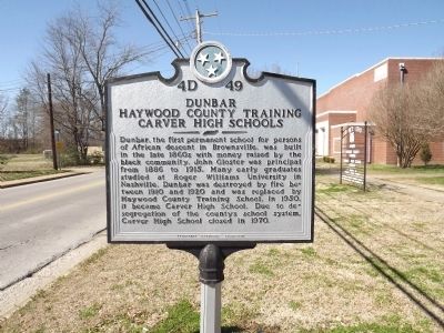
Dunbar Marker image. Click for full size.
Photographed By Ken Smith, February 25, 2012
1. Dunbar Marker
Inscription. Dunbar, the first permanent school for persons of African descent in Brownsville, was built in the late 1860s with money raised by the black community. John Gloster was principal from 1886 to 1915. Many early graduates studied at Roger Williams University in Nashville. Dunbar was destroyed by fire between 1910 and 1920 and was replaced by Haywood County Training School. In 1950, it became Carver High School. Due to desegregation of the county's school system, Carver High School closed in 1970.
 
Erected by Tennessee Historical Commission. (Marker Number 4D 49.)
 
Topics and series. This historical marker is listed in these topic lists: African AmericansEducation. In addition, it is included in the Historically Black Colleges and Universities, and the Tennessee Historical Commission series lists. A significant historical year for this entry is 1886.
 
Location. 35° 35.512′ N, 89° 15.329′ W. Marker is in Brownsville, Tennessee, in Haywood County. Marker is on Jefferson Street (Tennessee Route 19) east of Park Avenue, on the left when traveling east. Touch for map. Marker is in this post office area: Brownsville TN 38012, United States of America. Touch for directions.
 
Other nearby markers. At least 8 other markers are within walking distance of this marker. Rawls Funeral Home (approx. 0.3 miles away); Golden Circle Life Insurance Company (approx. 0.3 miles away);
Paid Advertisement
Click on the ad for more information.
Please report objectionable advertising to the Editor.
Click or scan to see
this page online
Elbert Williams (approx. 0.3 miles away); Hutchison-Elcan-Lynn (approx. 0.4 miles away); Lot Number 1 (approx. 0.4 miles away); First United Methodist Church (approx. 0.4 miles away); Opera House (approx. 0.4 miles away); Fighting for Freedom (approx. 0.4 miles away). Touch for a list and map of all markers in Brownsville.
 
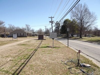
Dunbar Marker image. Click for full size.
Photographed By Ken Smith, February 25, 2012
2. Dunbar Marker
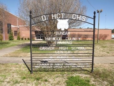
Dunbar School Sign image. Click for full size.
Photographed By Ken Smith, February 25, 2012
3. Dunbar School Sign
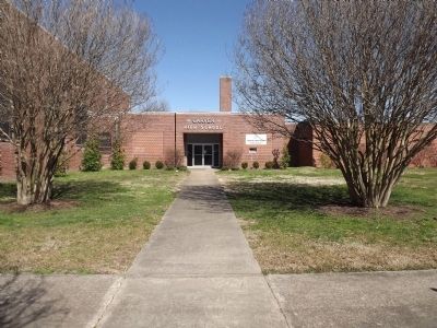
Carver High School image. Click for full size.
Photographed By Ken Smith, February 25, 2012
4. Carver High School
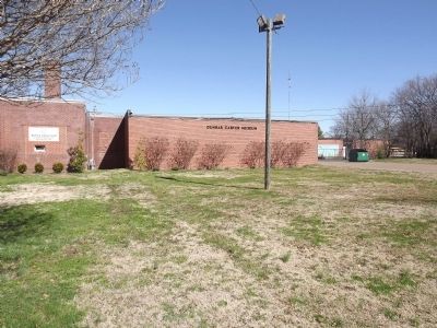
Dunbar Carver Museum image. Click for full size.
Photographed By Ken Smith, February 25, 2012
5. Dunbar Carver Museum
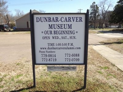
Dunbar Carver Museum image. Click for full size.
Photographed By Ken Smith, February 25, 2012
6. Dunbar Carver Museum
 
 
Credits. This page was last revised on September 3, 2023. It was originally submitted on February 27, 2012, by Ken Smith of Milan, Tennessee. This page has been viewed 839 times since then and 30 times this year. Photos:   1, 2, 3, 4, 5, 6. submitted on February 27, 2012, by Ken Smith of Milan, Tennessee. • Bill Pfingsten was the editor who published this page.
Share this page.  
Share on Tumblr
m=53003

CeraNet Cloud Computing sponsors the Historical Marker Database.
This website earns income from purchases you make after using our links to Amazon.com. We appreciate your support.
Paid Advertisement
Apr. 23, 2024