Near Elyria in McPherson County, Kansas — The American Midwest (Upper Plains)
Kansas Indian Treaty
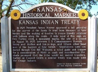
In 1825 President James Monroe approved a bill providing for the survey of the Santa Fe Trail from Missouri to New Mexico and the making of treaties to insure friendly relations with Indians along the route. A mile west of this sign, on Dry Turkey Creek, a monument marks the site of a council on August 16, 1825, between U.S. Commissioners Reeves, Sibley and Mather, and Son-ja-inga and fifteen other head men of the Kansas or Kaw nation. Negotiations were conducted through "Old Bill" Williams, a noted guide and trapper. For a consideration of $800 in cash and merchandise the chiefs promised that the tribe would not molest travelers. Earlier, at Council Grove, a similar treaty was made with the Osage Indians.
Erected by Kansas Historical Society and State Highway Commission. (Marker Number 33.)
Topics and series. This historical marker is listed in these topic lists: Exploration • Industry & Commerce • Native Americans • Roads & Vehicles. In addition, it is included in the Former U.S. Presidents: #05 James Monroe, the Kansas Historical Society, and the Santa Fe Trail series lists. A significant historical year for this entry is 1825.
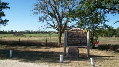
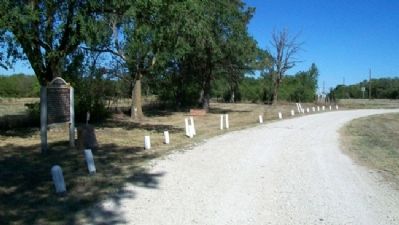
Location. 38° 17.208′ N, 97° 37.33′ W. Marker is near Elyria, Kansas, in McPherson County. Marker is on Old U.S. 81, 0.3 miles south of Comanche Road, on the right when traveling south. Marker is at a roadside pullout. Touch for map. Marker is in this post office area: McPherson KS 67460, United States of America. Touch for directions.
Other nearby markers. At least 8 other markers are within 6 miles of this marker, measured as the crow flies. Sora Kansas Creek (here, next to this marker); Veterans Memorial (approx. 5˝ miles away); Swiss (Volhynian) Mennonite Memorial (approx. 5.6 miles away); The Swiss (Yolhynian) Mennonites (approx. 5.6 miles away); Anabaptist - Mennonite Faith & Life (approx. 5.6 miles away); Centennial Memorial (approx. 5.6 miles away); Turkey Red Wheat (approx. 5.6 miles away); Growth of This Pioneer Group (approx. 5.6 miles away).
Also see . . .
1. US Treaty with Kansa, 1825. First People - Treaties and Agreements entry (Submitted on February 28, 2012, by William Fischer, Jr. of Scranton, Pennsylvania.)
2. Kaw Nation. (Submitted on February 28, 2012, by William Fischer, Jr. of Scranton, Pennsylvania.)
3. Santa Fe National Historic Trail. (Submitted on February 28, 2012, by William Fischer, Jr. of Scranton, Pennsylvania.)
Credits. This page was last revised on December 31, 2020. It was originally submitted on February 28, 2012, by William Fischer, Jr. of Scranton, Pennsylvania. This page has been viewed 764 times since then and 33 times this year. Photos: 1, 2, 3. submitted on February 28, 2012, by William Fischer, Jr. of Scranton, Pennsylvania.


