Centreville in Fairfax County, Virginia — The American South (Mid-Atlantic)
Centreville, Virginia
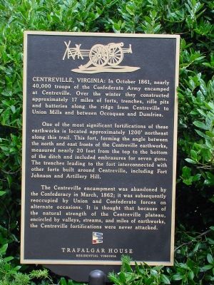
In October 1861, nearly 40,000 troops of the Confederate Army encamped at Centreville. Over the winter they constructed approximately 17 miles of forts, trenches, rifle pits and batteries along the ridge from Centreville to Union Mills and between Occoquan and Dumfries.
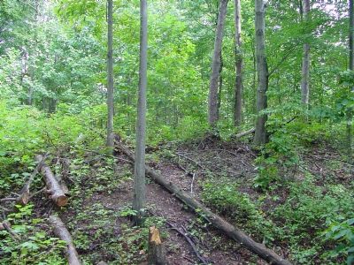
One of the most significant fortifications of these earthworks is located approximately 1200 feet northeast along this trail. This fort, forming the angle between the north and east fronts of the Centreville earthworks, measured nearly 20 feet from the top to the bottom of the ditch and included embrasures for seven guns. The trenches leading to the fort interconnected with other forts built around Centreville, including Fort Johnson and Artillery Hill.
The Centreville encampment was abandoned by the Confederacy in March, 1862; it was subsequently reoccupied by Union and Confederate forces on alternate occasions. It is thought that because of the natural strength of the Centreville plateau, encircled by valleys, streams, and miles of earthworks, the Centreville fortifications were never attacked.
Erected by Trafalgar House / Residential Virginia.
Topics. This historical marker is listed in these topic lists: Forts and Castles • War, US Civil. A significant historical month for this entry is March 1862.
Location. 38° 50.566′ N, 77° 25.403′ W. Marker is in Centreville, Virginia, in Fairfax County. Marker is on Pickwick Road north of U.S. 29, on the right when traveling north. Touch for map. Marker is at or near this postal address: 5609 Pickwick Rd, Centreville VA 20120, United States of America. Touch for directions.
Other nearby markers. At least 5 other markers are within walking distance of this marker. St. John's Episcopal Church (approx. 0.2 miles away); On This Site (approx. 0.2 miles away); a different marker also named St. John's Episcopal Church (approx. 0.2 miles away); A Place on the High Ground (approx. 0.2 miles away); Historic Centreville Park (approx. ¼ mile away). Touch for a list and map of all markers in Centreville.
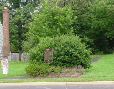
More about this marker. Marker is in a residential neighborhood and marks the entrance to a wooded walking trail between two houses that takes you to the earthwork remains.
Also see . . .
1. Fortifications on Heights of Centreville, Virginia. Photograph from [Alexander] Gardner's Photographic Sketch Book of the War on the George Eastman House International Museum of Photography and Film website. (Submitted on September 17, 2006.)
2. Civil War Photographs of Centreville. These photos are on Frank Harrell's website. (Submitted on September 17, 2006.)
Credits. This page was last revised on July 7, 2021. It was originally submitted on September 17, 2006, by J. J. Prats of Powell, Ohio. This page has been viewed 3,117 times since then and 48 times this year. Photos: 1, 2, 3. submitted on September 17, 2006, by J. J. Prats of Powell, Ohio.


