Columbus in Platte County, Nebraska — The American Midwest (Upper Plains)
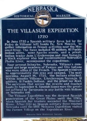
The Villasur Expedition
1720
In June 1720 a Spanish military force led by Sir Pedro de Villasur left Santa Fe, New Mexico, to gather information on French activities near the Missouri River. The force included 45 veteran soldiers, 60 Pueblo Indian allies, some Apache scouts, and a priest. Indian trader Juan L'Archeveque, and Jose Naranjo, a black explorer who had reconnoitered Nebraska's Platte River, accompanied the expedition.
Near present Schuyler, Nebraska, Villasur's command met large numbers of Pawnee and Oto Indians who were allies of the French. The Spanish withdrew to approximately this area and camped. The next morning, August 14, 1720, the Indians attacked. Within minutes Villasur, L'Archeveque, Naranjo, 3l soldiers, 11 Pueblo Indians, and the priest lay dead. The survivors fled across the prairie and reached Santa Fe September 6. Spanish losses were the greatest suffered by Europeans in any battle with Indians on Nebraska soil.
The Villasur expedition was the deepest official penetration of the Great Plains until the 1790s, when Spanish fur traders ascended the Missouri River. After 1720 no Spanish military force reached Nebraska country until the 1806 Melgares Expedition visited the Pawnee village on the Republican River.
Erected by Nebraska State Historical Society. (Marker Number 305.)
Topics and series. This historical marker is listed in these topic lists: Disasters • Exploration • Hispanic Americans • Native Americans. In addition, it is included in the Nebraska State Historical Society series list. A significant historical month for this entry is June 1720.
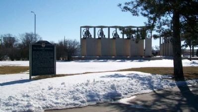
Location. 41° 25.382′ N, 97° 22.126′ W. Marker is in Columbus, Nebraska, in Platte County. Marker is at the intersection of 33rd Avenue (U.S. 30/81) and 7th Street, on the right when traveling south on 33rd Avenue. Marker is in Pawnee Park. Touch for map. Marker is in this post office area: Columbus NE 68601, United States of America. Touch for directions.
Other nearby markers. At least 8 other markers are within walking distance of this marker. St. Bernard Catholic Church Bell (within shouting distance of this marker); a different marker also named St. Bernard Catholic Church Bell (within shouting distance of this marker); Congregational Church Bell (within shouting distance of this marker); a different marker also named St. Bernard Catholic Church Bell (within shouting distance of this marker); Good Shepherd Lutheran Church Bell (within shouting distance of this marker); North Branch, Oregon Trail (within shouting distance of this marker); The Columbus Quincentenary Belltower (within
shouting distance of this marker); United Methodist Church Bell (within shouting distance of this marker). Touch for a list and map of all markers in Columbus.
Also see . . .
1. Villasur Expedition. (Submitted on March 3, 2012, by William Fischer, Jr. of Scranton, Pennsylvania.)
2. "Villasur Massacre Gets a New Look". (Submitted on March 3, 2012, by William Fischer, Jr. of Scranton, Pennsylvania.)
Credits. This page was last revised on November 30, 2020. It was originally submitted on March 3, 2012, by William Fischer, Jr. of Scranton, Pennsylvania. This page has been viewed 1,119 times since then and 36 times this year. Photos: 1, 2. submitted on March 3, 2012, by William Fischer, Jr. of Scranton, Pennsylvania.

