Annapolis in Anne Arundel County, Maryland — The American Northeast (Mid-Atlantic)
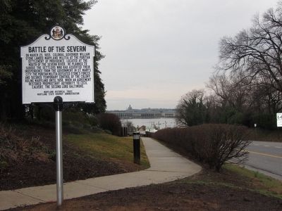
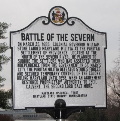
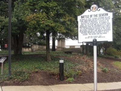
Battle of the Severn
Erected by Maryland Historical Trust, Maryland State Highway Administration.
Topics and series. This historical marker is listed in these topic lists: Colonial Era • Government & Politics • Settlements & Settlers. In addition, it is included in the Maryland Historical Trust series list. A significant historical month for this entry is March 1918.
Location. 38° 59.929′ N, 76° 28.912′ W. Marker is in Annapolis, Maryland, in Anne Arundel County. Marker is at the intersection of Ritchie Highway (Maryland Route 450) and Chase Road, on the left when traveling south on Ritchie Highway. Marker is next to the parking lot for the Annapolis Overlook. Touch for map. Marker is at or near this postal address: 1919 Ritchie Hwy, Annapolis MD 21409, United States of America. Touch for directions.
Other nearby markers. At least 8 other markers are within walking distance of this marker. Albert Cabell Ritchie (within shouting distance of this marker); Prisoner of War Memorial (within shouting distance of this marker); Pearl Harbor Survivors Association (within shouting distance of this marker); Maryland World War II Memorial (within shouting distance of this marker); Gold Star Families Monument (about 400 feet away, measured in a direct line); Jonas and Anne Catherine Green Park (approx. 0.3 miles away); Providence - 1649 (approx. 0.3 miles away); Standing Guard (approx. 0.3 miles away). Touch for a list and map of all markers in Annapolis.
Regarding Battle of the Severn. The Battle of the Severn may have been the last battle of the English Civil War, which pitted royal forces associated with the Catholic King against the Puritan forces associated with the Commonwealth. In Maryland, the Civil War was carried out similarly by forces loyal to the Catholic Proprietor of Maryland against a Puritan settlement loyal to the Commonwealth. In both cases, the Puritans were victorious, although the Puritan government in England restored the Catholic proprietorship in Maryland.

Photographed By F. Robby, March 3, 2012
3. Battle of the Severn Marker
Looking toward the Severn River, and the US Naval Academy (across the river). The mouth of the Severn is about a mile to the left of this view. The Puritan settlement was on this side of the Severn, but the land battle occurred on the south side, near the present day Eastport section of Annapolis.

New York Public Library
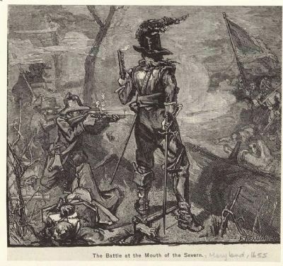
4. The Battle of the Mouth of the Severn
Reportedly the first battle between opposing American soldiers.
Image Title: The battle at the mouth of the Severn. Creator: Kelly, James Edward, 1855-1933 -- Artist Depicted Date: 1655 Specific Material Type: Prints Catalog Call Number: PC AME-164 Digital ID: 808180 Record ID: 700978 Digital Item Published: 10-27-2005; updated 3-25-2011
Image Title: The battle at the mouth of the Severn. Creator: Kelly, James Edward, 1855-1933 -- Artist Depicted Date: 1655 Specific Material Type: Prints Catalog Call Number: PC AME-164 Digital ID: 808180 Record ID: 700978 Digital Item Published: 10-27-2005; updated 3-25-2011
Credits. This page was last revised on March 25, 2022. It was originally submitted on March 3, 2012, by F. Robby of Baltimore, Maryland. This page has been viewed 2,318 times since then and 88 times this year. Photos: 1, 2, 3, 4. submitted on March 3, 2012, by F. Robby of Baltimore, Maryland.

