La Grange in Fayette County, Texas — The American South (West South Central)
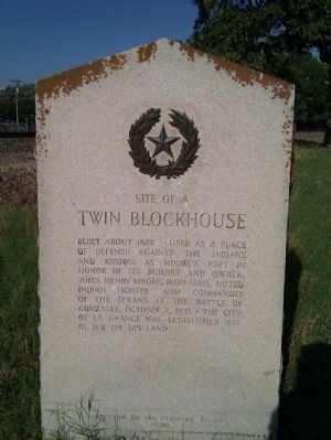
Site of a Twin Blockhouse
Erected 1936 by State of Texas. (Marker Number 5580.)
Topics and series. This historical marker is listed in these topic lists: Forts and Castles • Settlements & Settlers. In addition, it is included in the Texas 1936 Centennial Markers and Monuments series list. A significant historical date for this entry is May 17, 1910.
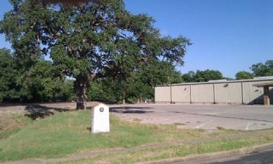
Location. 29° 54.394′ N, 96° 52.819′ W. Marker is in La Grange, Texas, in Fayette County. Marker is on North Main Street north of West Lafayette Street, on the left when traveling north. North of railroad crossing on west side of the street. Touch for map. Marker is at or near this postal address: 385 N Main St, La Grange TX 78945, United States of America. Touch for directions.
Other nearby markers. At least 8 other markers are within walking distance of this marker. La Grange Depot Museum (about 500 feet away, measured in a direct line); The Dawson Expedition / Historic Oak Tree (about 600 feet away); Texas Rangers Memorial (about 600 feet away); Lester Hotel (about 700 feet away); Grandmother's Flower Garden (about 700 feet away); Fayette County Veterans Memorial (about 700 feet away); Fayette County Courthouse (about 700 feet away); Sundial (about 700 feet away). Touch for a list and map of all markers in La Grange.
Credits. This page was last revised on June 16, 2016. It was originally submitted on March 4, 2012, by Gregory Walker of La Grange, Texas. This page has been viewed 901 times since then and 28 times this year. Photos: 1, 2. submitted on March 4, 2012, by Gregory Walker of La Grange, Texas. • Bernard Fisher was the editor who published this page.

