Near Netawaka in Jackson County, Kansas — The American Midwest (Upper Plains)
Battle of the Spurs
Inscription.
New Inscription
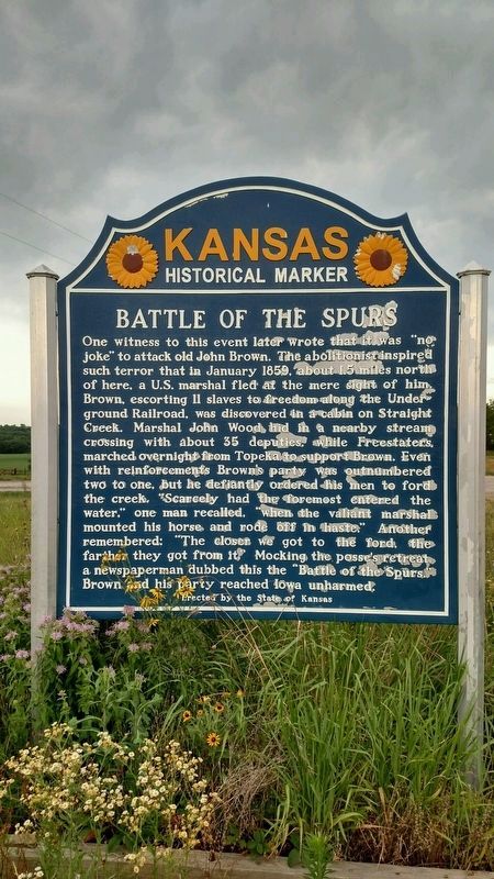
One witness to this event later wrote that it was “no joke” to attack old John Brown. The abolitionist inspired such terror that in January 1859, about 1.5 miles north of here, a U.S. marshal fled at the mere sight of him. Brown, escorting 11 slaves to freedom along the Underground Railroad, was discovered in a cabin on Straight Creek. Marshal John Wood hid in a nearby stream crossing with about 35 deputies, while Freestaters marched overnight from Topeka to support Brown. Even with reinforcements Brown’s party was outnumbered two to one, but he defiantly ordered his men to ford the creek. “Scarcely had the foremost entered the water,” one man recalled, “when the valiant marshal mounted his horse and rode off in haste.” Another remembered: “The closer we got to the ford, the farther they got from it.” Mocking the posse’s retreat, a newspaperman dubbed this the “Battle of the Spurs.” Brown and his party reached Iowa unharmed.
Old Inscription
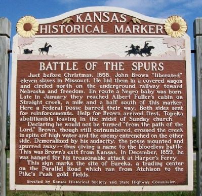
Just before Christmas, 1858, John Brown "liberated" eleven slaves in Missouri. He hid them in a covered wagon and circled north on the underground railway toward Nebraska and freedom. En route a Negro baby was born. Late in January they reached Albert Fuller's cabin on Straight creek, a mile and a half south of this marker. Here a Federal posse barred their way. Both sides sent for reinforcements. Help for Brown arrived first, Topeka abolitionists leaving in the midst of Sunday church.
Declaring he would not be turned "from the path of the Lord," Brown, though still outnumbered, crossed the creek in spite of high water and the enemy entrenched on the other side. Demoralized by his audacity, the posse mounted and spurred away -- thus giving a name to the bloodless battle. This was Brown's exit from Kansas. In December, 1859, he was hanged for his treasonable attack at Harper's Ferry.
This sign marks the site of Eureka, a trading center on the Parallel Road which ran from Atchison to the Pike's Peak gold fields.
Erected by The State of Kansas. (Marker Number 17.)
Topics and series. This historical marker is listed in these topic lists: Abolition & Underground RR • African Americans. In addition, it is included in the Kansas Historical Society series list.
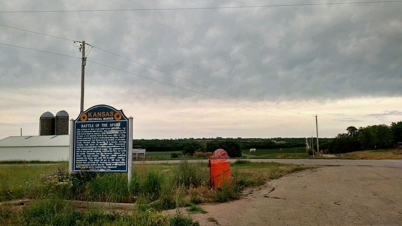
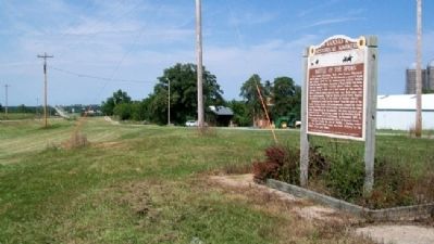
Location. 39° 33.972′ N, 95° 43.991′ W. Marker is near Netawaka, Kansas, in Jackson County. Marker is at the intersection of U.S. 75 and 286th Road, on the left when traveling south on U.S. 75. Marker is about 2.5 miles south of Netawaka. Touch for map. Marker is in this post office area: Netawaka KS 66516, United States of America. Touch for directions.
Other nearby markers. At least 8 other markers are within
8 miles of this marker, measured as the crow flies. The Wetmore Calaboose (approx. 6.3 miles away); Don Clarence Rising (approx. 6½ miles away); Jackson County Courthouse Horse Water Trough (approx. 7 miles away); Fort Jim Lane (approx. 7 miles away); Edward D. Holton (approx. 7 miles away); Civil War Memorial (approx. 7.1 miles away); Company E, 137th Infantry Regt, 35th Infantry Div (approx. 7.1 miles away); Livestock Water Trough (approx. 7.2 miles away).
More about this marker. Marker was replaced in 2012.
Also see . . .
1. The Battle of the Spurs and John Brown's Exit from Kansas. Kansas Historical Society website entry (Submitted on March 7, 2012, by William Fischer, Jr. of Scranton, Pennsylvania.)
2. Territorial Kansas Online. Website homepage (Submitted on March 7, 2012, by William Fischer, Jr. of Scranton, Pennsylvania.)
Credits. This page was last revised on July 22, 2023. It was originally submitted on March 7, 2012, by William Fischer, Jr. of Scranton, Pennsylvania. This page has been viewed 1,675 times since then and 76 times this year. Last updated on July 15, 2023, by Jeff Leichsenring of Garland, Texas. Photos: 1. submitted on June 19, 2018, by Mike Wintermantel of Pittsburgh, Pennsylvania. 2. submitted on March 7, 2012, by William Fischer, Jr. of Scranton, Pennsylvania. 3. submitted on June 19, 2018, by Mike Wintermantel of Pittsburgh, Pennsylvania. 4. submitted on March 7, 2012, by William Fischer, Jr. of Scranton, Pennsylvania. • Bill Pfingsten was the editor who published this page.


