Bolivar in Jefferson County, West Virginia — The American South (Appalachia)
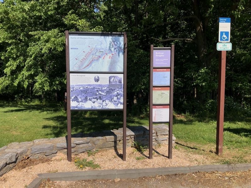
Battle of Harpers Ferry / Union Stronghold
Harpers Ferry National Historical Park
— National Park Service, U.S. Department of the Interior —

Photographed By Devry Becker Jones (CC0), May 21, 2021
1. Battle of Harpers Ferry / Union Stronghold Marker
Battle of Harpers Ferry
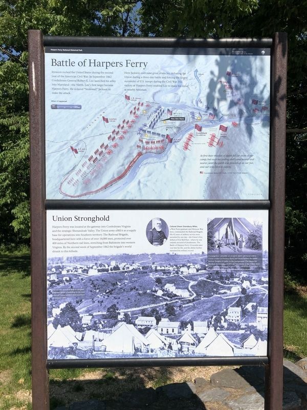
Invasion rocked the United States during the second year of the American Civil War. In September 1862 Confederate General Robert E. Lee launched his army into Maryland - the North. Lee's first target became Harpers Ferry. He ordered "Stonewall" Jackson to make the attack.
Here Jackson overcame great obstacles, defeating the Union during a three-day battle and forcing the largest surrender of U.S. troops during the Civil War. His victory at Harpers Ferry enabled Lee to make his stand at nearby Antietam.
At first their missiles of death fell far short of our camp; but each succeeding shell came nearer and nearer, until the earth was plowed up at our feet, and our tents torn to tatters.
Lieutenant James H. Clark, 115th New York Infantry
Union Stronghold
Harpers Ferry was located at the gateway into Confederate Virginia and the strategic Shenandoah Valley. The Union army used it as a supply base for operations into Southern territory. The Railroad Brigade, headquartered here with a force of over 14,000 men, protected over 400 miles of Northern rail lines, stretching from Baltimore into western Virginia. By the second week of September 1862 the brigade's world shrank to this hillside.
Erected by National Park Service, U.S. Department of the Interior.
Topics. This historical marker is listed in this topic list: War, US Civil. A significant historical month for this entry is September 1862.
Location. 39° 19.434′ N, 77° 45.667′ W. Marker is in Bolivar, West Virginia, in Jefferson County. Marker is at the intersection of Prospect Avenue (County Road 27/1) and Whitman Avenue, on the left when traveling north on Prospect Avenue. Located at the parking lot for the Bolivar Heights tour stop at Harpers Ferry Historical Park. Touch for map. Marker is at or near this postal address: 47 Spring Street, Harpers Ferry WV 25425, United States of America. Touch for directions.
Other nearby markers. At least 8 other markers are within walking distance of this marker. Harpers Ferry (a few steps from this marker); Bolivar Heights Trail (a few steps from this marker); Historic Heights (within shouting distance of this marker); Facing the Enemy (within shouting distance of this marker); Closing the Doors (within shouting distance of this marker); The First Year of War (within shouting distance of this marker); Rats in a Cage (within shouting distance of this marker); Casualties of War (about 400 feet away, measured in a direct line). Touch for a list and map of all markers in Bolivar.
More about this marker. The upper panel has a relief map of Harpers Ferry as a background with icons detailing the positions of important units during the siege. The location

Photographed By Devry Becker Jones (CC0), May 21, 2021
2. Battle of Harpers Ferry / Union Stronghold Marker
The lower panel has a wartime photo of "The mostly denuded Bolivar Heights ridgeline," which "forms a backdrop to the tent cities of Union soldiers stationed here in the summer of 1862."
In the upper right is a portrait of "Colonel Dixon Stansbury Miles, a West Point graduate and Mexican War hero, commanded the Railroad Brigade. His 42 years of military service were tarnished by one day - the Union's first defeat at Bull Run - where he was unjustly accused of drunkeness. The Battle of Harpers Ferry 14 months later cost him his life, and the defeat further tarnished his military record."
Beside the portrait is a photo of "A young boy - possibly an escaped slave - pictured with a Union soldier in Harpers Ferry just weeks before the battle. Bolivar Heights is visible in the background. The desire for freedom drove enslaved African Americans to the Union lines here at Harpers Ferry, but when the Confederates captured the town hundreds were forced to return to slavery."
Also see . . . 1862 Battle of Harpers Ferry. National Park Service summary of the battle. (Submitted on February 12, 2008, by Craig Swain of Leesburg, Virginia.)
Credits. This page was last revised on May 21, 2021. It was originally submitted on February 12, 2008, by Craig Swain of Leesburg, Virginia. This page has been viewed 3,547 times since then and 26 times this year. Last updated on April 26, 2020, by Larry Gertner of New York, New York. Photos: 1, 2. submitted on May 21, 2021, by Devry Becker Jones of Washington, District of Columbia. • Devry Becker Jones was the editor who published this page.