Near Canton in McPherson County, Kansas — The American Midwest (Upper Plains)
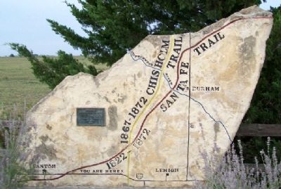
Santa Fe and Chisholm Trails
1867-1872 Chisholm Trail
[trail maps through local area]
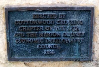
Erected 1995 by Cottonwood Crossing Chapter, STFA, and the Marion County Economic Development Council.
Topics and series. This historical marker is listed in these topic lists: Industry & Commerce • Roads & Vehicles • Settlements & Settlers. In addition, it is included in the Santa Fe Trail series list.
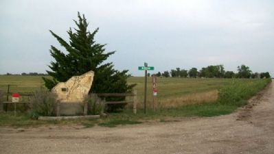
Location. 38° 22.627′ N, 97° 22.309′ W. Marker is near Canton, Kansas, in McPherson County. Marker is at the intersection of 30th Avenue / Meridian and 210th Street, on the right when traveling north on 30th Avenue / Meridian. Marker is about 300 feet north of U.S. Highway 56, and about 3 miles east of Canton. Touch for map. Marker is in this post office area: Canton KS 67428, United States of America. Touch for directions.
Other nearby markers. At least 8 other markers are within 10 miles of this marker, measured as the crow flies. Last Built Carnegie Library (approx. 3.1 miles away); Frantz L. Groening (approx. 3.8 miles away); Santa Fe Trail (approx. 4˝ miles away); Banman Wheat Threshing Stone (approx. 8.3 miles away); The Mennonites in Kansas (approx. 8.3 miles away); Alexanderfeld Village (approx. 8˝ miles away); Hillsboro Airport (approx. 8.7 miles away); A Place of Meditation (approx. 9.2 miles away).
Also see . . .
1. The Great Prairie Highway. National Park Service Santa Fe National Historic Trail entry (Submitted on March 15, 2012, by William Fischer, Jr. of Scranton, Pennsylvania.)
2. Santa Fe Trail Association. Association homepage (Submitted on March 15, 2012, by William Fischer, Jr. of Scranton, Pennsylvania.)
Credits. This page was last revised on January 18, 2022. It was originally submitted on March 15, 2012, by William Fischer, Jr. of Scranton, Pennsylvania. This page has been viewed 854 times since then and 64 times this year. Photos: 1, 2, 3. submitted on March 15, 2012, by William Fischer, Jr. of Scranton, Pennsylvania.


