Mozley Park in Atlanta in Fulton County, Georgia — The American South (South Atlantic)
The Federal Salient
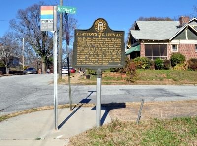
Clayton’s div. (S, D. Lee’s A. C.) attacked the angle with Gibson’s, Baker’s & Holtzclaw’s brigades [CS]. This was the Right of the Confederate line.
The post-war structure, Battle Hill school, stood at the S.E. cor. of Laurel Ave. & Archer St
Erected 1958 by Georgia Historical Commission. (Marker Number 060-144.)
Topics and series. This historical marker is listed in this topic list: War, US Civil. In addition, it is included in the Georgia Historical Society series list. A significant historical date for this entry is July 28, 1781.
Location. Marker has been reported missing. It was located near 33° 45.055′ N, 84° 26.417′ W. Marker was in Atlanta, Georgia, in Fulton County. It was in Mozley Park. Marker was at the intersection of Laurel Avenue SW and Archer Street SW, on the left when traveling south on Laurel Avenue SW. Touch for map. Marker was at or near this postal address: Laurel Avenue SW, Atlanta GA 30314, United States of America. Touch for directions.
Other nearby markers. At least 8 other markers are within walking distance of this location. Clayton's Div., Lee's A.C. (a few steps from this marker); Battle of Ezra Church (approx. 0.2 miles away); a different marker also named Clayton’s Div., Lee’s A.C. (approx. 0.2 miles away); a different marker also named Battle of Ezra Church (approx. ¼ mile away); The Confederate Attack (approx. ¼ mile away); The Union Dispositions (approx. ¼ mile away); The Battle of Ezra Church / The Preliminary Operations (approx. ¼ mile away); Battle of Ezra Ch. (approx. 0.3 miles away). Touch for a list and map of all markers in Atlanta.
More about this marker. The marker was last recorded as standing at this location in 2000, leaving the post standing. In 2010 or 2011 another marker, removed from a nearby location, was installed here on the original post for a different marker.
Text for the missing marker was taken from “Georgia Historical Markers” (Bay Tree Grove, Second Edition 1978) compiled by Carroll P. Scruggs from the records of the Georgia Historical Commission.
Credits. This page was last revised on February 8, 2023. It was originally submitted on March 19, 2012, by David Seibert of Sandy Springs, Georgia. This page has been viewed 673 times since then and 7 times this year. Photos: 1. submitted on May 31, 2016. 2. submitted on March 19, 2012, by David Seibert of Sandy Springs, Georgia. • Craig Swain was the editor who published this page.

