Mozley Park in Atlanta in Fulton County, Georgia — The American South (South Atlantic)
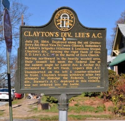
Clayton's Div., Lee's A.C.
Inscription.
July 28, 1864. Deployed along the old Greensferry Rd. (West View Dr.) were Gibson’s, Holtzclaw’s & Baker’s brigades (Alabama & Louisiana troops), Clayton’s div., forming the right flank of Gen. S. D. Lee’s A. C. [CS] in the Battle Of Ezra Church.
Moving northward in the heavily wooded area, their assault fell upon the Federal line at the salient angle (at Laurel Ave. & Archer. St.), occupied by the left flank, Logan’s 15th A. C. Unsupported on the left & counter-attacked in front, Clayton’s troops withdrew after two attempts to dislodge the Federals. Loring’s div., Stewart’s A. C., deployed in this vicinity, was not ordered into the battle.
Erected 1958 by Georgia Historical Commission. (Marker Number 060-145.)
Topics and series. This historical marker is listed in this topic list: War, US Civil. In addition, it is included in the Georgia Historical Society series list. A significant historical date for this entry is July 28, 1915.
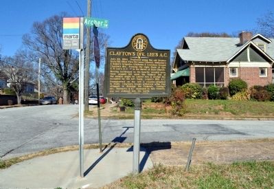
Location. 33° 45.046′ N, 84° 26.409′ W. Marker is in Atlanta, Georgia, in Fulton County. It is in Mozley Park. Marker is at the intersection of Laurel Avenue SW and Archer Street SW, on the right when traveling north on Laurel Avenue SW. Touch for map. Marker is in this post office area: Atlanta GA 30314, United States of America. Touch for directions.
Other nearby markers. At least 8 other markers are within walking distance of this marker. Battle of Ezra Church (approx. 0.2 miles away); a different marker also named Clayton’s Div., Lee’s A.C. (approx. 0.2 miles away); a different marker also named Battle of Ezra Church (approx. ¼ mile away); The Confederate Attack (approx. ¼ mile away); The Union Dispositions (approx. ¼ mile away); The Battle of Ezra Church / The Preliminary Operations (approx. ¼ mile away); Battle of Ezra Ch. (approx. 0.3 miles away); a different marker also named Battle of Ezra Ch. (approx. half a mile away). Touch for a list and map of all markers in Atlanta.
More about this marker. This marker was originally installed at Wellington and Elixir Streets, from where it vanished about 1980. (A replacement marker was installed at that site in 1985; see marker no. 36085.) This marker was later recovered and installed on a new post across Interstate Highway 20 from the original location (see marker no. 53710). The marker vanished from that location prior to 1999. In 2009 or 2010 it was restored and installed on the post at this location (originally for “The Federal Salient”). That marker had vanished, leaving an empty – and available – post.
Credits. This page was last revised on February 8, 2023. It was originally submitted on March 19, 2012, by David Seibert of Sandy Springs, Georgia. This page has been viewed 754 times since then and 18 times this year. Last updated on February 21, 2022, by Thomas Cole of Marietta, Georgia. Photos: 1, 2. submitted on March 19, 2012, by David Seibert of Sandy Springs, Georgia. • Bernard Fisher was the editor who published this page.

