Memphis in Shelby County, Tennessee — The American South (East South Central)
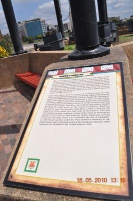
North Carolina
In the 1700s, the western boundary of the British Crown Colony of North Carolina extended, in theory, to the Mississippi River. Much of this was academic, however, and the western Tennessee territory which bordered the river was in fact the property of the Chickasaw Indians. In the Revolutionary War, Mountain Men from the Tennessee frontier fought in North Carolina militia units at the battle of King's Mountain, but at the end of the war, the new State of North Carolina and its citizens were left in serious financial trouble, and the Chickasaw lands were looked upon as a source of economic gain. In 1783, North Carolina opened a land office to sell entry claims to the property between the Mississippi and Tennessee Rivers, despite the Chickasaws' rights. This official land grab prompted a rush of claim filing, and about 2 million acres of the Chickasaw lands were sold, largely to the politicians and leading citizens of North Carolina who had promoted the venture. John Rice, one of those speculators, bought the claim to 5,000 acres on the Fourth Chickasaw Bluff on October 23, 1783. Two day later, John Ramsey filed a claim for the 5,000 acres to the south. Rice had come to the bluff in 1783 and surveyed this property, marking a corner of his claim by hacking his initials on a tree. He was later killed by Native Americans, leaving to his heirs the land which was to become the site of Memphis. In 1789, North Carolina ceded the West Tennessee territory to the United States, and it remained a part of the Southwest Territory until Tennessee was admitted to the United States in 1796.
Erected by Mud Island River Park.
Topics. This historical marker is listed in these topic lists: Exploration • Native Americans • Settlements & Settlers. A significant historical month for this entry is October 1673.
Location. 35° 8.659′ N, 90° 3.561′ W. Marker is in Memphis, Tennessee, in Shelby County. Marker can be reached from Island Road, one mile south of A.W. Willis Avenue. Marker is at the south end of Mud Island under the NC flag. Touch for map. Marker is at or near this postal address: 125 North Front Street, Memphis TN 38103, United States of America. Touch for directions.
Other nearby markers. At least 8 other markers are within walking distance of this marker. Tennessee (here, next to this marker); France (here, next to this marker); Great Britain (here, next to this marker); Confederate States of America (a few steps from this marker); Spain (a few steps from this marker); Memphis Queen II (approx. 0.2 miles away); Cobblestones (approx. 0.2 miles away); Civil War Hospital (approx. ¼ mile away). Touch for a list and map of all markers in Memphis.
Also see . . . Mud Island River Park. Memphis
River Parks entry (Submitted on March 20, 2012, by Bernard Fisher of Richmond, Virginia.)
Credits. This page was last revised on April 13, 2021. It was originally submitted on March 20, 2012, by Sandra Hughes Tidwell of Killen, Alabama, USA. This page has been viewed 535 times since then and 28 times this year. Photos: 1, 2, 3. submitted on March 20, 2012, by Sandra Hughes Tidwell of Killen, Alabama, USA. • Bernard Fisher was the editor who published this page.


