Randsburg in Kern County, California — The American West (Pacific Coastal)
Randsburg Drug Store
Rand Mining District Centennial
— 1895 - 1995 —
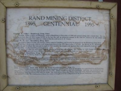
Nicholas N. Miller – Randsburg Drug Store
Nicholas Miller, a native of Michigan, came to Randsburg in December of 1896 and opened a drug store a month later. He was burnt out in both fires of 1898 losing $4,000 in the last fire and an unknown amount in the first fire. However he did rebuild and remained in business until 1900 when it is believed that he sold out to G. W. Turner.
George W. Turner – Randsburg Drug Store
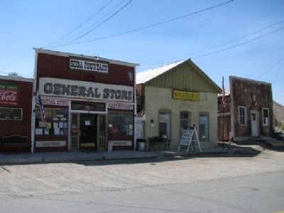
As a young man of twenty one George W. Turner came to Randsburg and became the proprietor of the Randsburg Drug Store. He faced his share of adversity with his store being burnt down in the 1903 fire at a loss of $3,000. He did not let this discourage him however, and he rebuilt the store and in April of 1904 installed the elegant soda fountain that is still enjoyed by local and visitor alike when they visit the Randsburg General Store.
In August of 1904 his wife Pattie filed for divorce accusing him of infidelity. By October of 1905 George had decided that enough was enough and sold out to Western Drug Co. Mr. Landers, of Los Angeles, took over as business manager.
R.S. Chency- Randsburg Drug Store
In July of 1905 R. S. Cheney, from Los Angeles, purchased the Randsburg Drug Store.
Carl J. Spencer
Carl J. Spencer is listed in the Great Register of Voters, as a druggist in Randsburg from 1910 to 1916. It is considered likely that he was the druggist for the Randsburg Drug Store during this period. It is not known however if he owned the store or was just working as the druggist.
Oscar Glanville
Oscar who was also in business in Mojave, Ca, was listed as the druggist in Randsburg from 1916-1919 when he moved his business to Modesto.
Anna (Gunderson) Jones and Wilson H. Jones – Gunderson-Jones Drug Co.
Anna (Gunderson) Jones the widow of Daniel Gunderson and Wilson H. Jones are thought to have purchased the old Randsburg Drug Store from Oscar Glanville when he left town in 1919. Daniel Gunderson had run a bookstore, stationary, and newsstand next to the Randsburg Drug Store from 1906 until his death. The 1920 census shows that Wilson Jones was in the retail merchant business and was married to Anna. The combination of these two stories is thought to be the configuration of the present Randsburg General Store.
Erected 1995 by Randsburg Museum.
Topics. This historical marker is listed in these topic lists: Industry & Commerce • Notable Buildings. A significant historical month for this entry is April 1904.
Location. 35° 22.085′ N, 117° 39.375′ W. Marker is in Randsburg
, California, in Kern County. Marker is on Butte Avenue, on the right when traveling north. Touch for map. Marker is at or near this postal address: 35 Butte Avenue, Randsburg CA 93554, United States of America. Touch for directions.
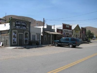
Other nearby markers. At least 8 other markers are within walking distance of this marker. D.T. Jones - Dry Goods (a few steps from this marker); Whitehouse Saloon (a few steps from this marker); The Joint (within shouting distance of this marker); Rand Mining District (within shouting distance of this marker); The Commercial Hotel (about 300 feet away, measured in a direct line); Randsburg, California (about 400 feet away); The King Solomon Mine (approx. 0.8 miles away); Rand District Community Cemetery (approx. 0.9 miles away). Touch for a list and map of all markers in Randsburg.
Credits. This page was last revised on June 16, 2016. It was originally submitted on March 24, 2012, by Denise Boose of Tehachapi, California. This page has been viewed 654 times since then and 13 times this year. Photos: 1, 2, 3, 4. submitted on March 24, 2012, by Denise Boose of Tehachapi, California. • Syd Whittle was the editor who published this page.


